


About Sweetwater Day Use Area (GA)
Seasonal information
2026 Season availability
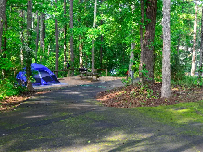
Campground Amenities
Most popular amenities
 Playground

On Site Services
- Playground

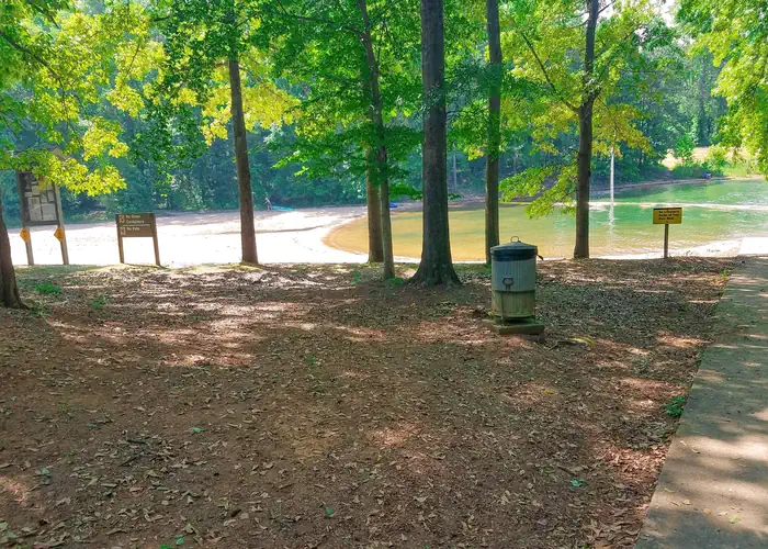
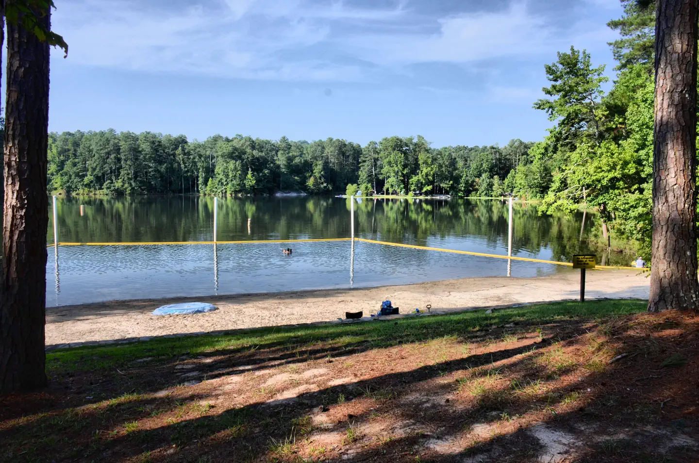
Water Access
- Beach Access
Report Incorrect Information
Help us improve by reporting any incorrect amenity information for Sweetwater Day Use Area (GA).
Reviews (6)
What Guests Are Saying
The trail system at Sweetwater Day Use Area is well-regarded, allowing for a rewarding triple loop encompassing both the east and west loops. It includes a connector trail to the Allatoona Dam visitor center, making for a total distance of approximately 10 miles with a 2000 ft elevation gain. This combination offers a challenging yet enjoyable hiking experience.
Review Summary

Mitch Taylor
December 10, 2025
This is a great trail system. I do a triple loop including both the east and west loops up to the summit. I add the connector trail over to the Allatoona Dam visitor center and I loop down to Cooper's Furnace then back to the connector then to the trailhead. All total it's about 10 miles and 2000 ft elevation gain.

Nevil Jay
April 2, 2024
This is a difficult trail. I can't give the trail a negative rating for this reason, though. I went based on AllTrails rating it moderate. It wasn't, not to me. Lots of inclines, with slippery and rough surfaces. My father had knee pain by the time he was up top and didn't want to come back down. We took multiple breaks because the parents (both in their 60s) were tired. But, to be fair, even my younger sibling and I, who routinely go to the gym, got tired here. It's a trail to test your determination because the view at the end is gorgeous and worth getting to.

Brittany McCumber
September 17, 2023
View of Georgia at the Overlook is worth the hike. Well blazed and maintained trail (Thanks Cartersville!) Moderate hike and intensity. Low traffic. Leaves are just starting to turn…beautiful

Steven Redmond
April 25, 2023
Great place to hike. There are two different parking lots on either side of the park. The parking lot on the south side is much larger. Trails are heavily used but it's still a great hike.

Drew Postell
December 31, 2022
Nice little hike to peak of Pine Mountain. Elevation is 1560 feet and you start around 750 feet. 1.23 miles to the top and there are some rocky and steeper sections of the trail. I feel that young kids would be ok here but older hikers would need a good hiking stick for some assistance. They do allow bikes here on some days....and some bikers choose to ignore those rules...just be weary of that if you have smaller children. Dog friendly as well.
kelly e
June 28, 2022
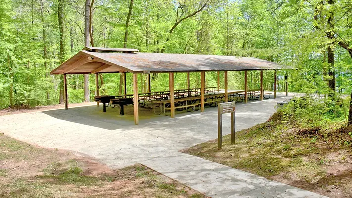
We had a wonderful experience for our event at Sweetwater Campground Day Use Pavilion. The whole pavilion was Clean and the lights turned on for us. The grounds were maintained and the bathrooms were cleaned before our guests arrived. The Gate staff were extremely kind and helpful. Overall a great experience!
6/25/22
Location Sweetwater Day Use Area (GA)
Address:
1138 Georgia Highway Spur 20
Cartersville, GA, 30121
United States
From I-75, take exit 290 which is the Hwy 20 exit. Northbound traffic will turn right onto Hwy 20 and southbound traffic will turn left onto Hwy 20. Go east on Hwy 20 towards Canton for approximately 10.2 miles. Turn right onto Fields Chapel Road (gas station on the corner). Travel 1.4 miles go past the campground entrance (on right) and road will dead end into the entrance of the Day Use Area.
From I-575, take exit 14 which is the Hwy 5 exit. Northbound will turn left onto Hwy 5 and southbound traffic will turn right onto Hwy 5. Turn left onto Butterworth Road and travel 1.7 miles to the traffic light at Hwy 20. Turn left onto Hwy 20 West and go 2.6 miles. Turn left onto Fields Chapel Road (gas station on the corner). Travel 1.4 miles go past the campground entrance (on right) and road will dead end into the entrance of the Day Use Area.
Physical address: Sweetwater Day Use Area, 1505 Fields Chapel Road, Canton, Georgia 30114
Sweetwater Day Use Area is accessible via State Route 20, which is approximately 5 miles away. Additionally, Interstate 575 is about 10 miles to the west, providing further connectivity.
Latitude & Longitude: 34.1983 / -84.5757
Elevation: 270 feet
Policies & Rules
General
- Alcohol is NOT PERMITTED.
- Pets are NOT PERMITTED.
- Shelter has a maximum seating capacity of 100 people/maximum 40 vehicles.
- Tables under the shelter are chained in place and cannot be moved.
- After , any unused parking spaces will be released to the general public on a first-come, first-served basis.
- Walk-ins, trailer parking, bus parking or parking outside of the gate is NOT PERMITTED.
- It is the responsibility of the person making the reservation to inform their guests of these rules.
- No dunk tanks, pools, slip & slides, etc. permitted in this area. Call 678-721-6700 for questions.
- No water balloons, confetti, or any other small miscellanous items that are harmful to wildlife in the area.
- If you choose to reserve a shelter, it is the Shelter Reservation holder's responsbility to ensure the facility is left in clean and good condition.
- For driving directions to the Day Use Area, please refer to the "Getting Here" section under the "Facility Information" tab. The Day Use shelter is NOT located within Sweetwater Campground.
Nearby Campgrounds
Last updated: July 11, 2026