Warning
GeneralDam Site Closure - The west side of Dam Site (including the Dam Site North boat ramp) will be closed in May 2026 for the bridge deck replacement across the Fort Gibson dam. Access will be restricted to construction and Corps personnel only. Area will be closed for a minimum of 2 1/2 years. Dam Site East fishing wall and the Overlook areas will remain open.


Featured amenities
 Picnic Table
 River Access
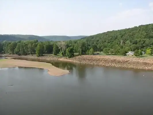
About Dam Site (Fort Gibson Lake)
Available sites
24 total sites Tent Sites
Activities & Attractions
Nearby

Fishing
Hiking
Year-round
Fishing
Hiking
Seasonal information
2026 Season availability
Campground Amenities
Most popular amenities
Picnic Table
River Access

Cooking and Fire
- Picnic Table

Water Access
- River Access
Rates, Sites & Availability
24 Sites Available
No sites found matching your criteria.
No available sites
All sites are booked for your selected dates. Try showing all sites to see booked options, create an alert to be notified when something opens up, or adjust your dates.
Site Details
Select a site to view details
24 Sites Available
No available sites
All sites are booked for your selected dates. Try showing all sites to see booked options, create an alert to be notified when something opens up, or adjust your dates.
Reviews
0 reviews
Location & Directions for Dam Site (Fort Gibson Lake)
8711 Hwy 251 A, Fort Gibson, OK 74434 United States
Elevation: 160 ft


Highway access
The campground is accessible via State Highway 51, which is approximately 5 miles to the north and connects to U.S. Highway 69, providing further access to major routes in the region.
Policies & Rules
General
- Don't Move Firewood: Protect your forests from tree-killing pests by buying your firewood locally and buring it on-site. Visit Dontmovefirwood.org for further information.
Warnings & Advisories
Warning
GeneralDam Site Closure - The west side of Dam Site (including the Dam Site North boat ramp) will be closed in May 2026 for the bridge deck replacement across the Fort Gibson dam. Access will be restricted to construction and Corps personnel only. Area will be closed for a minimum of 2 1/2 years. Dam Site East fishing wall and the Overlook areas will remain open.
Nearby Campgrounds


Nearby destinations

Last updated: October 23, 2026

Need help?
Our team is here to help you find the perfect spot for your next adventure.
Replies within minutes
Explore Fort Gibson, OK
Population: 3,808
Nearby city: Broken Arrow, OK
Approx. 34 mi away (straight-line distance)
Elevation: 564 ft
Fort Gibson, OK
Weather & Conditions
From our Travel Guides