


About Lone Pine Campground
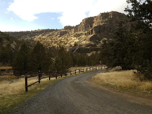
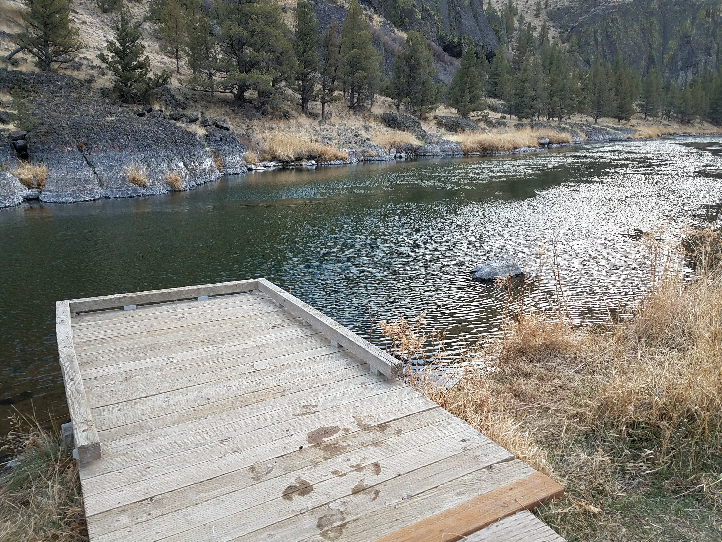
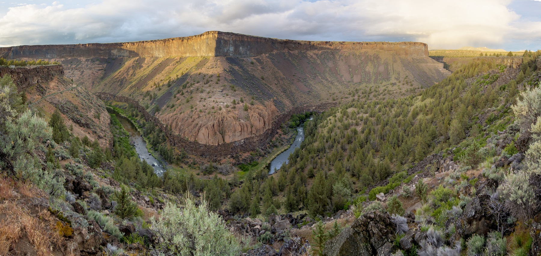
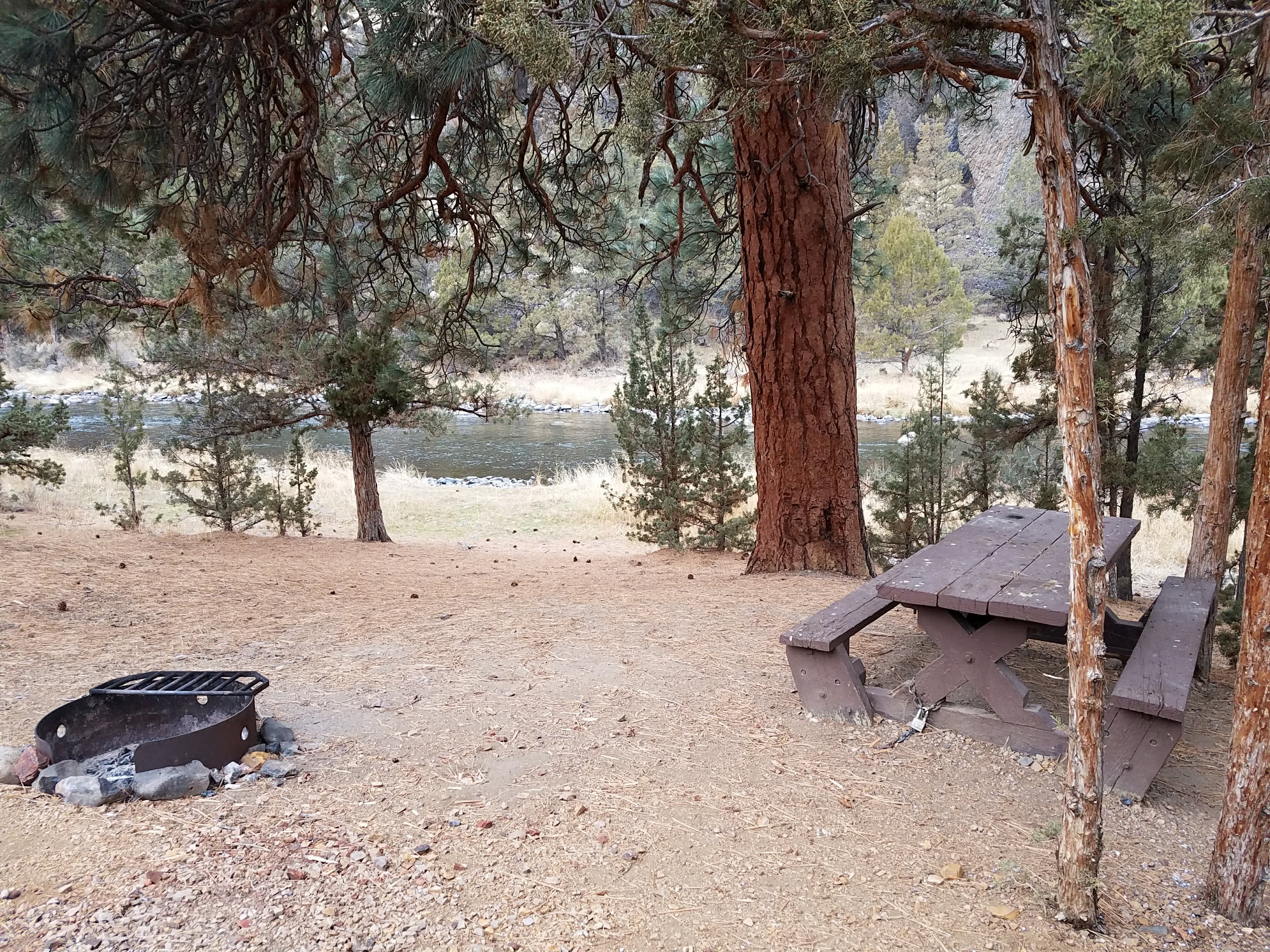
Centered around a single, sentinel Ponderosa Pine tree, this small campground features six campsites and a group use area. Across the Crooked River, the photogenic Rocky Canyon and its vertical rimrock cliffs offer photographers a variety of ever-changing light and depth perspectives.Know Before You Go:Open year-round on a first-come, first-served basis. No reservations are accepted.Potable water is available year-round at Chimney Rock Campground, 1.7 miles miles west (upriver) on State Highway 27.Cell phone service is not available in the campground.Watch for bicyclists: the section of State Highway 27 between Prineville and Bowman Dam is designated as the Crooked River Canyon Scenic Bikeway.Point of Interest:Since 2008, reintroduction of Steelhead trout has been underway in the Deschutes River Basin, which includes the wild and scenic Chimney Rock segment of the Crooked River. The success of this reintroduction is in part dependent on stresses placed on this fish. Anglers should keep them in the water and release them immediately; the harvesting of Steelhead in the Crooked River is unlawful.
Activities & Attractions
Nearby

Cycling
Year-round

Fishing
Year-round

Photography
Year-round
Year-round
Cycling
Nearby
Fishing
Nearby
Photography
Nearby
Location Lone Pine Campground
Address:
Prineville District Office, 3050 Ne 3rd Street
Prineville, OR, 97754
United States
Highway access
Lone Pine Campground is located approximately 15 miles from US Highway 26, providing access to major routes in the region.
Latitude & Longitude: 44.1314 / -120.823
Elevation: 934 feet
Nearby Campgrounds
Nearby destinations
Last updated: July 11, 2026
Managed by Bureau of Land Management