

About Oregon Buttes Wsa
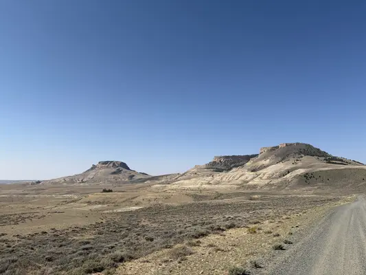
The Oregon Buttes WSA encompasses 5,700 acres of BLM-administered land with no private or state inholdings. The buttes are a prominent landmark, rising out of the northwestern portion of the Red Desert to an elevation of 8.6 ft. The area includes a wide variety of vegetation types including limber pine stands, thick aspen stands and wet meadows. The Oregon Buttes are an island in the Red Desert and were a landmark for settlers traveling the Oregon Trail. Opportunities for primitive and unconfined recreation are outstanding in the WSA. Being prime raptor habitat, the buttes provide bird watchers with a variety of species and uninterrupted observation. The WSA is also a prime area for scenic and wildlife photography, offering a unique variety of settings and subjects. Other recreation opportunities include hiking, rock climbing, rock hounding, backpacking, hunting, horseback riding and sightseeing. This is a fee-free site. The boundary route is accessible in most locations.
Reviews
0 reviews
Location & Directions for Oregon Buttes Wsa
Rock Springs Field Office, 280 Highway 191 North, Rock Springs, WY 82901 United States
Elevation: 2,460 ft


Nearby Campgrounds

Nearby destinations

Last updated: October 7, 2026

Need help?
Our team is here to help you find the perfect spot for your next adventure.
Message us
Replies within minutes
Rock Springs, WY
Weather & Conditions
Loading destination weather
From our Travel Guides



Managed by the Bureau of Land Management