About Ya-gub-weh-tuh Campground
Reviews (5)
What Guests Are Saying
Ya-gub-weh-tuh Campground offers a scenic 20-minute hike to a bridge, with access to multiple trails along the river, making it ideal for both new and experienced hikers. The trails are well-maintained and accommodating for equestrian use, dog walkers, and mountain bikers. A $5 day-use fee applies, and visitors are advised to bring plenty of water and snacks, especially in the heat of June.
Review Summary

Leo R.
April 20, 2022
Beautiful hike! It was a great workout. The surrounding views are so pretty. It was peaceful, quiet and refreshing. You can hear the river, which was so relaxing. Perfect for the whole family, and furbabies. There are lots of cows around, so there's droppings on the trail, but not so terrible you can't walk. It gets hot quickly, so bring plenty of water. The parking lot is small, and there's a $5 fee. There's a vault bathroom there, not too bad. There was no TP, so bring wipes. There's also a small picnic area next to the parking lot. The road to get to the Trailhead was windy and narrow, mostly down hill, a little rough on the brakes. But uphill on the way out. There was no Verizon coverage at all, until I was closer to town and the 168.

nine2-5traveler
June 1, 2025
This trailhead serves as a starting point for a few other trails: Foot Bridge, Pa' San Ridge, Wuh-kí-o, San Joaquin River (and then the river access trail).
There is a day-use fee schedule so be sure to review the fee schedule before you head out ($5 for the day/car). Also, there is a bathroom, some day-use tables and picnic areas.
I used this trailhead to access pa'san ridge. The pa'san trail is a challenging yet manageable trail. The challenge is some sections are very narrow, there's a slight elevation gain, it gets hot as soon as the sun crests, and it's a 6- mile loop... but factor in the Foot Bridge trail - you're now at 8 mi total. It's manageable primarily because it's a packed trail, very easy to follow.
Speaking of the trail, I recommend some hiking footwear or trail shoe; a tennis shoe or sneaker technically will work but: not safe and your feet will hurt.
There's a few sections of the trail where you'll get some shade helping with the sun exposure and heat.
Bring plenty of water; it's better to pack too much than not enough. On this hike, I went thru 48oz of water before I reached the bridge. Bring food or a snack to keep you energized.
There's some wildlife along the trail but definitely watch for the skunks.
This isa very well kept and maintained trail that is shared with dog walkers, horse riders, and mountain bikers.
Eyes open and heads up.

Madge Gai (Madge)
June 22, 2025
Just done the loop today. Total 7.7 mi hike. Beautiful valley view, some ups and downs but easy enough for everyone to do it. Definitely recommend lots of water. June is dry and the heat will beat you. I walked most of the trail, finished in 3 hours.

Joshua Humphries
February 19, 2026
As a brand new hiker, I took the family here due to it being a relatively easy to hike.
It was a great experience! There are adjacent trails to veer off on. It was neat to have to go through the cattle gates.
We had a blast!

J J
March 6, 2026
Easy 20 minute hike to the bridge. Connects to many trails along the river. Equestrian friends. Camping nearby. Day use fee is $5
Location & Directions for Ya-gub-weh-tuh Campground
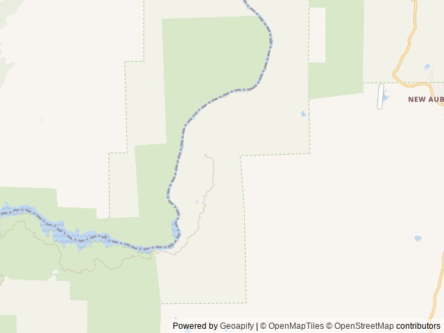
Bureau Of Land Management, San Joaquin River Gorge Visitor Center, 40060 Smalley Road, Auberry, CA 93602 United States
Elevation: 311 ft
Nearby National Park
South Entrance
Approximate driving time: over 1 hr (62 min)
Big Stump Entrance Station
Approximate driving time: over 1 hr (86 min)
Nearby Campgrounds

Last updated: October 7, 2026

Need help?
Our team is here to help you find the perfect spot for your next adventure.
Replies within minutes
Explore Auberry, CA
Population: 3,240
Elevation: 1,959 ft
From our Travel Guides