Top Campgrounds near Kingman
Popular Filters
Gould's Rim Trail
Recommended Users: Mountain Bikers, Hikers. Singletrack trail. 3 miles in length. Difficulty: Moderate/Easiest. This trail is easy flowing singletrack through rolling desert hills. The terrain is ...
Water Canyon Trail
Recommended Users: Hikers. Route. 3.2 miles in Length. Difficulty: Moderate. The start of this hike travels along a sandy trail through brush as you get closer to the start of the canyon you will e...
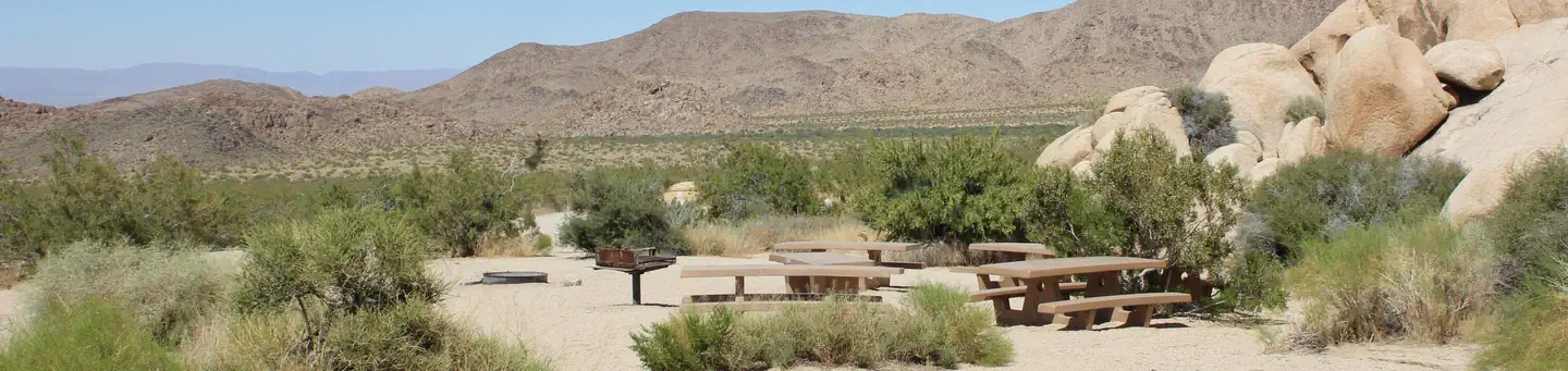
Indian Cove Group
Download the NPS app prior to visiting the park – trail maps and more! Indian Cove Campground lies amid the huge, steep rock formations for which Joshua Tree National Park is known. Because of it...
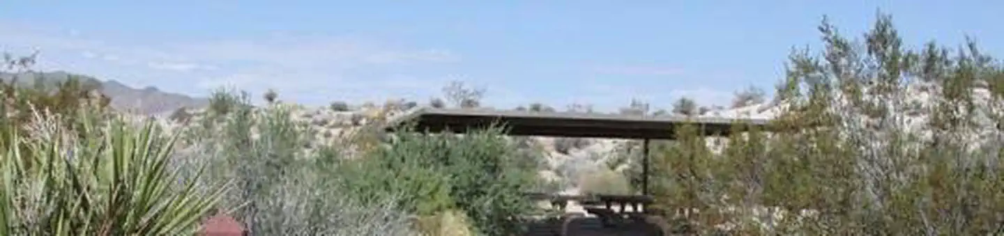
Cottonwood Group
Download the NPS app prior to visiting the park – trail maps and more! Cottonwood Group Campground is one of the best places in Joshua Tree National Park for stargazing and wildflower viewing. Th...
From $55/night

Cottonwood Campground (CA)
Download the NPS app prior to visiting the park – trail maps and more! Cottonwood Campground is one of the best places in Joshua Tree National Park for stargazing and wildflower viewing. Easy acce...
From $35/night
Gould's Trail
Recommended Users: Mountain Bikers, Hikers. Singletrack trail. 2.4 miles in length. Difficulty: Moderate/Easiest. Gould’s Trail is rolling singletrack through soft desert soils. It wends its way do...
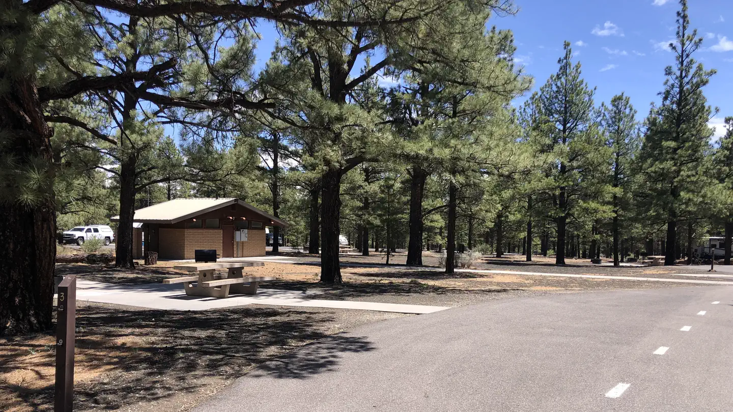
Bonito Campground (AZ)
Bonito Campground is located 18 miles northeast of Flagstaff, near Sunset Crater/Wupatki National Monument. Elevation is 6,900 feet. Bonito Campground is named for the Bonito Lava Flow which oozed ...
From $34/night
More Cowbell Trail
Recommended Users: Mountain Bikers, Hikers. Singletrack trail. 2.5 miles in length. Difficulty: Moderate/Easiest. More Cowbell Trail is a short loop that circles the rim of a small mesa. To reach t...
Squirrel Mountain Trail
Recommended Users: Hikers. Route. 6 total miles in length. Difficulty: Moderate. This hike goes to the the top of Canaan Mountain. This hike contains slickrock and an area know as the beehive. It o...
Short Creek Trail
Recommended Users: Hikers. 2.7 miles in length. Difficulty: Moderate. From Squirrel Canyon Trailhead, follows sand trail along Short Creek, continues past the Squirrel Canyon trail turn off.
White Domes Trail
Recommended Users: Hikers. Route. 1.36 miles in length. Difficulty: Moderate. The White Domes Trail is a continuation of the Water Canyon trail. It travels through the Canaan Mountain Wilderness an...
Canaan Mountain Trail
Recommended Users: Hikers. Two-track. 9 miles in length. Difficulty: Strenuous.
Red Reef Trail
Trail Description Trail Distance: 5.74 miles (one way) Approximate Elevation Gain/Loss: 600 feet From the Red Reef Trailhead The Red Reef Trail follows the Quail Creek drainage as it...
White Trail
Recommended Users: Mountain Bikers, Hikers, OHVers. Two-track/Singletrack. 3.09 miles in length. Difficulty: Easiest. This trail is an old 4x4 road that bisects the Gooseberry Mesa. It’s has a few...
North Rim Trail
Recommended Users: Mountain Bikers, Hikers. Singletrack trail. 2.1 miles in length. Difficulty: More Difficult. A classic single track with a mix of dirt, rock, trees, and exposure. Like the Windm...
Yellow Trail
Recommended Users: Mountain Bikers, Hikers. Singletrack trail. 0.54 miles in length. Difficulty: Most Difficult. Although this trail is entirely on SITLA (School Institutional Trust Lands), it is l...
Water Canyon Arch Trail
Recommended Users: Hikers. Route. 3.2 miles in Length. Difficulty: Moderate. The start of this hike travels along a sandy trail through brush as you get closer to the start of the canyon you will e...
Hidden Canyon Trail
Recommended Users: Mountain Bikers, Hikers. Singletrack trail. 1.9 miles in length. Difficulty: Most Difficult. Hidden Canyon is aptly named. The trail is a mix of dirt and slick rock that winds t...
Connector Trail
Recommended Users: Mountain Bikers, Hikers. Singletack trail. 0.08 miles in length. Difficulty: Easiest. The Connector Trail is used as a bail-out route from the North Rim Trail. Conversely it off...

Moccasin Mountain Dinosaur Tracksite
The Moccasin Mountain Dinosaur Tracksite is one of Utah’s most significant fossil track localities located on BLM-managed lands near Kanab. Visitors can explore the track-bearing surfaces on foot a...
Popular Filters
Gould's Rim Trail
Recommended Users: Mountain Bikers, Hikers. Singletrack trail. 3 miles in length. Difficulty: Moderate/Easiest. This trail is easy flowing singletrack through rolling desert hills. The terrain is ...
Water Canyon Trail
Recommended Users: Hikers. Route. 3.2 miles in Length. Difficulty: Moderate. The start of this hike travels along a sandy trail through brush as you get closer to the start of the canyon you will e...
Indian Cove Group
Download the NPS app prior to visiting the park – trail maps and more! Indian Cove Campground lies amid the huge, steep rock formations for which Joshua Tree National Park is known. Because of it...
Cottonwood Group
Download the NPS app prior to visiting the park – trail maps and more! Cottonwood Group Campground is one of the best places in Joshua Tree National Park for stargazing and wildflower viewing. Th...
From $55/night
Cottonwood Campground (CA)
Download the NPS app prior to visiting the park – trail maps and more! Cottonwood Campground is one of the best places in Joshua Tree National Park for stargazing and wildflower viewing. Easy acce...
From $35/night
Gould's Trail
Recommended Users: Mountain Bikers, Hikers. Singletrack trail. 2.4 miles in length. Difficulty: Moderate/Easiest. Gould’s Trail is rolling singletrack through soft desert soils. It wends its way do...
Bonito Campground (AZ)
Bonito Campground is located 18 miles northeast of Flagstaff, near Sunset Crater/Wupatki National Monument. Elevation is 6,900 feet. Bonito Campground is named for the Bonito Lava Flow which oozed ...
From $34/night
More Cowbell Trail
Recommended Users: Mountain Bikers, Hikers. Singletrack trail. 2.5 miles in length. Difficulty: Moderate/Easiest. More Cowbell Trail is a short loop that circles the rim of a small mesa. To reach t...
Squirrel Mountain Trail
Recommended Users: Hikers. Route. 6 total miles in length. Difficulty: Moderate. This hike goes to the the top of Canaan Mountain. This hike contains slickrock and an area know as the beehive. It o...
Short Creek Trail
Recommended Users: Hikers. 2.7 miles in length. Difficulty: Moderate. From Squirrel Canyon Trailhead, follows sand trail along Short Creek, continues past the Squirrel Canyon trail turn off.
White Domes Trail
Recommended Users: Hikers. Route. 1.36 miles in length. Difficulty: Moderate. The White Domes Trail is a continuation of the Water Canyon trail. It travels through the Canaan Mountain Wilderness an...
Canaan Mountain Trail
Recommended Users: Hikers. Two-track. 9 miles in length. Difficulty: Strenuous.
Red Reef Trail
Trail Description Trail Distance: 5.74 miles (one way) Approximate Elevation Gain/Loss: 600 feet From the Red Reef Trailhead The Red Reef Trail follows the Quail Creek drainage as it...
White Trail
Recommended Users: Mountain Bikers, Hikers, OHVers. Two-track/Singletrack. 3.09 miles in length. Difficulty: Easiest. This trail is an old 4x4 road that bisects the Gooseberry Mesa. It’s has a few...
North Rim Trail
Recommended Users: Mountain Bikers, Hikers. Singletrack trail. 2.1 miles in length. Difficulty: More Difficult. A classic single track with a mix of dirt, rock, trees, and exposure. Like the Windm...
Yellow Trail
Recommended Users: Mountain Bikers, Hikers. Singletrack trail. 0.54 miles in length. Difficulty: Most Difficult. Although this trail is entirely on SITLA (School Institutional Trust Lands), it is l...
Water Canyon Arch Trail
Recommended Users: Hikers. Route. 3.2 miles in Length. Difficulty: Moderate. The start of this hike travels along a sandy trail through brush as you get closer to the start of the canyon you will e...
Hidden Canyon Trail
Recommended Users: Mountain Bikers, Hikers. Singletrack trail. 1.9 miles in length. Difficulty: Most Difficult. Hidden Canyon is aptly named. The trail is a mix of dirt and slick rock that winds t...
Connector Trail
Recommended Users: Mountain Bikers, Hikers. Singletack trail. 0.08 miles in length. Difficulty: Easiest. The Connector Trail is used as a bail-out route from the North Rim Trail. Conversely it off...
Moccasin Mountain Dinosaur Tracksite
The Moccasin Mountain Dinosaur Tracksite is one of Utah’s most significant fossil track localities located on BLM-managed lands near Kanab. Visitors can explore the track-bearing surfaces on foot a...
Kingman, Kansas
Find your perfect stay
The best deals for public & private campgrounds
Check availability & reserve your stay directly
Protect yourself from severe weather events
Frequently Asked Questions
Kingman has 197 campgrounds and RV parks listed on OutReserve, ranging from full-hookup RV sites to rustic tent camping. Based on guest ratings, Bonito Campground (AZ) is one of the top-rated options. Use our map view to find the closest options to the city center or your preferred area.
Campgrounds near Kingman vary in distance from the city center. Use our map view to filter by location and find the most convenient option for your trip.
Many campgrounds near Kingman welcome pets. Bonito Campground (AZ) is a great pet-friendly option. Use the pet-friendly filter on our search page to find more properties that accommodate your furry companions.
Most destinations offer a variety of accommodations including tent sites, RV sites, cabins, yurts, and glamping options. Check individual property listings for specific amenities and site types.
The best time to visit depends on your preferences and planned activities. Spring and fall typically offer mild weather and fewer crowds, while summer is peak season with the warmest temperatures. Winter visits can be great for those seeking solitude and winter activities.
Nearby cities
Why list with us?
List your Campground near Kingman on OutReserve
Do you own a campground or RV park near Kingman? List on OutReserve and connect with thousands of outdoor enthusiasts looking to stay in the area.
Free to List
Listing is completely free. You only pay a small commission when you receive a booking: no upfront costs, no hidden fees.
Reach Thousands
Connect with thousands of outdoor enthusiasts actively searching for their next camping adventure. Grow your bookings year-round.
Get Paid Fast
Receive payouts directly to your bank account after each stay. Fast, secure, and reliable so you can focus on your guests.