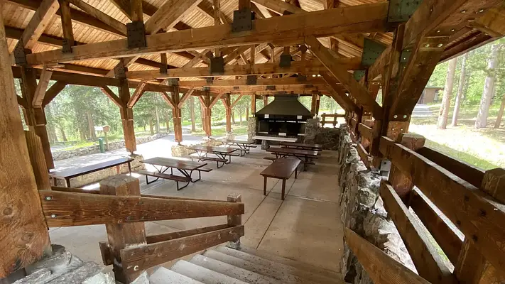


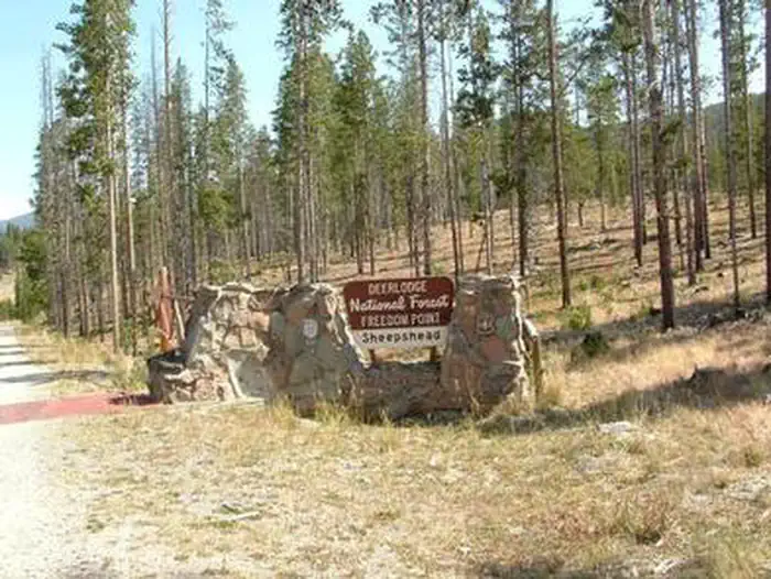
About Sheepshead Picnic Area
Seasonal information
2026 Season availability
Reviews (9)
What Guests Are Saying
Sheepshead Picnic Area is an excellent venue for large gatherings, offering ample space and a variety of activities. The paved paths ensure accessibility for all, including those in wheelchairs. The responsive forest service staff go the extra mile to maintain the area, making it a highly recommended spot for family reunions and events.
Review Summary
Heather M
December 23, 2025
We had a family reunion here and it was the perfect accommodations for our large group. My mother is in a wheelchair and was able to be with us wherever we went, thanks to the paved paths and handicap accessibility. There was a lot of variety for activities and space for all the things we planned.
Heather M
August 2, 2025
The picnic area was perfect for our family reunion and had tons of things to do. It rained and the pavilion easily sheltered 45 people. We will be going back in the future. What a true Montana treasure!
Heather M
August 2, 2025
The picnic area was perfect for our family reunion and had tons of things to do. It rained and the pavilion easily sheltered 45 people. We will be going back in the future. What a true Montana treasure!
Kloe L
September 9, 2024
The forest service was very cooperative and responsive! Loved working with them. They power washed the cow poop out of the pavilion for mine and my husband's wedding day! They TRULY went above and beyond.
Kloe L
September 9, 2024
The forest service was very cooperative and responsive! Loved working with them. They power washed the cow poop out of the pavilion for mine and my husband's wedding day! They TRULY went above and beyond.
Leah K
July 29, 2021
We had our daughters wedding here. We love this place. It’s beautiful and a perfect place to get away and just focus on what’s important.
Leah K
July 29, 2021
We had our daughters wedding here. We love this place. It’s beautiful and a perfect place to get away and just focus on what’s important.
Anonymous
Location Sheepshead Picnic Area
Address:
1820 Meadowlark Lane
Butte, MT, 59701
United States
From Butte, take I-15/I-90 east for approximately 1 mile. Merge onto I-15 north and continue for approximately 12 miles. Take the Elk Park exit (no. 138) and drive west on Forest Service road #442 (Lowland Creek Road) for approximately 6 miles. Turn right onto Forest Service road #9485 and continue for approximately 2 miles. Turn left at the junction (Freedom Point) and drive approximately 1/8 mile; the campground is on the right. The road is a gravel road suitable for passenger vehicle access.
Latitude & Longitude: 46.1556 / -112.465
Elevation: 1968 feet
Nearby Campgrounds
Nearby destinations
Last updated: July 11, 2026