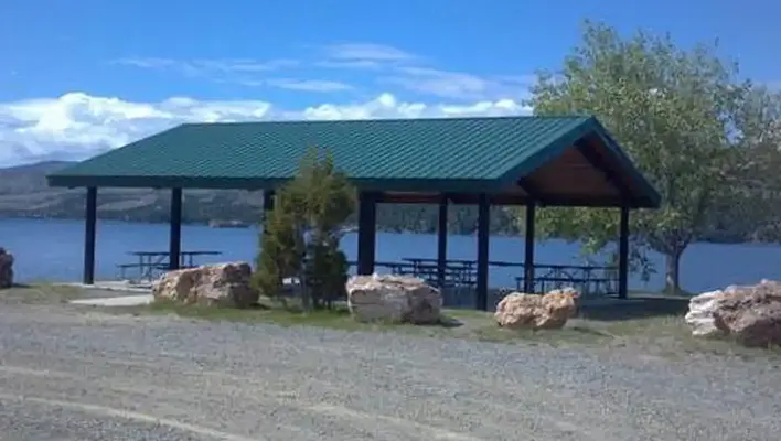


About Cave Point Group Use Area
Seasonal information
2026 Season availability
Campground Amenities
Most popular amenities
 Parking
 Picnic Table

Cooking and Fire
- Picnic Table

Parking and Transport
- Parking

Water Access
- Lake Access
Reviews (2)
What Guests Are Saying
Cave Point Group Use Area offers a fantastic location with stunning views and easy access to swimming and boating activities. Visitors appreciate the scenic beauty of the area. Overall, it's a great spot for outdoor enthusiasts.
What Guests Are Saying
Cave Point Group Use Area offers a fantastic location with stunning views and easy access to swimming and boating activities. Visitors appreciate the scenic beauty of the area. Overall, it's a great spot for outdoor enthusiasts.
Review Summary
Laurie T
July 17, 2026
The site location is great with beautiful views and access to swimming/boating.
Debbie M
January 16, 2020
This area was excellent for a group of people. it was so close to the lake you just needed to walk a couple feet to be right by the water. Everyone from the family reunion had a wonderful time. Thank you.
Location & Directions for Cave Point Group Use Area
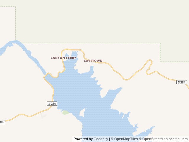
7700 Canyon Ferry Road, Helena, MT 59601 United States
Elevation: 1,159 ft
Getting There
If heading north along MT highway 12/287 from Townsend, MT, turn right onto Spokane Creek Rd. Follow Spokane Creek Rd for 4.6 mi and turn right onto Co Rd 430/Canyon Ferry Rd and continue 16 mi to Kim's Marina. Turn right into Kim's Marina and co...
If heading north along MT highway 12/287 from Townsend, MT, turn right onto Spokane Creek Rd. Follow Spokane Creek Rd for 4.6 mi and turn right onto Co Rd 430/Canyon Ferry Rd and continue 16 mi to Kim's Marina. Turn right into Kim's Marina and continue straight to Cave Point. If heading east along Co Rd 430/Canyon Ferry Rd from Helena, MT, continue for 16 mi to Kim's Marina. Turn right into Kim's Marina and continue straight to Cave Point.
Highway access
Cave Point Group Use Area is accessible via MT Highway 12/287 and Co Rd 430/Canyon Ferry Rd, which connects to Helena and Townsend.
Policies & Rules
General
- Cave Point Group Use Area is a day use only shelter and closes.
- No overnight camping or use is allowed.
- There is no electrical service at this shelter.
- While at Canyon Ferry Reservoir: CLEAN, DRAIN, DRY boats and any other recreational equipment that comes in contact with water. Never dump unwanted bait, worms, fish parts or other organisms into the water. For more information visit https://www.invasivespeciesinfo.gov/ STOP THE SPREAD OF INVASIVE SPECIES. REMOVE plants, seeds, animals and mud from boots, gear, pets, and vehicle. CLEAN your gear before entering and leaving the recreation site. STAY on designated roads and trails and use local firewood. For more information visit https://www.invasivespeciesinfo.gov/
Nearby Campgrounds


Nearby destinations
Last updated: October 7, 2026

Need help?
Our team is here to help you find the perfect spot for your next adventure.
Replies within minutes
From our Travel Guides