About Spring Recreation Site
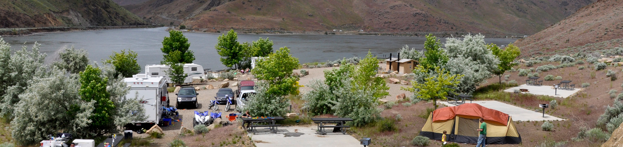
Overview:The Spring Recreation Site, or Spring Rec for short, is a camping and fishing location off the beaten path away from the crowds. Spring Rec sits on the banks of Brownlee Reservoir, a 52-mile long reservoir on the Snake River. The reservoir is known for its large channel catfish, abundant crappie, and good bass fishing. The RV and tent camping sites, boat launch, boarding dock, and fish cleaning station all create a comfortable camping and fishing experience. Spring Rec is ideal for the angler, those who love the outdoors, or for those just looking for a scenic getaway.Know Before You Go:All vehicles must display a stub from the fee envelope in their windshield.Drinking water is available.There are no RV hookups.Dumpsters are provided.Portable toilets are available throughout the site.Point of Interest:Brownlee Reservoir is generally full in the spring, but a drawdown begins in summer and may result in closure of the boat ramp at lower levels. Call the Baker BLM office at 541-523-1256 for current ramp conditions.The entire site overlooks the Reservoir, and there is a turnout off the gravel load leading up to the site that allows visitors to stop and look out over the campground and water.The site has apricot trees and grapevines that were planted by homesteaders who arrived via the Historic Oregon Trail. A train crosses over a nearby bridge spanning the Snake River, and the Farewell Bend State Recreation Area is also close by.
Campground Amenities
Most popular amenities
 Parking

Water and Hygiene
- Potable Water

Parking and Transport
- Parking

Water Access
- Boat Ramp / Launch
Missing information?
Report Incorrect Information
Help us improve by reporting any incorrect amenity information for Spring Recreation Site.
Location Spring Recreation Site
Address:
Vale District Office, 100 Oregon St.
Vale, OR, 97918
United States
Highway access
Spring Recreation Site is accessible via Oregon State Highway 201, which is approximately 10 miles away. The campground is located near the intersection of Snake River Road and Highway 201.
Latitude & Longitude: 44.3769 / -117.239
Elevation: 646 feet
Nearby Campgrounds
Nearby destinations
Last updated: July 11, 2026
Managed by Bureau of Land Management