Top Campgrounds near Bryce
Popular Filters
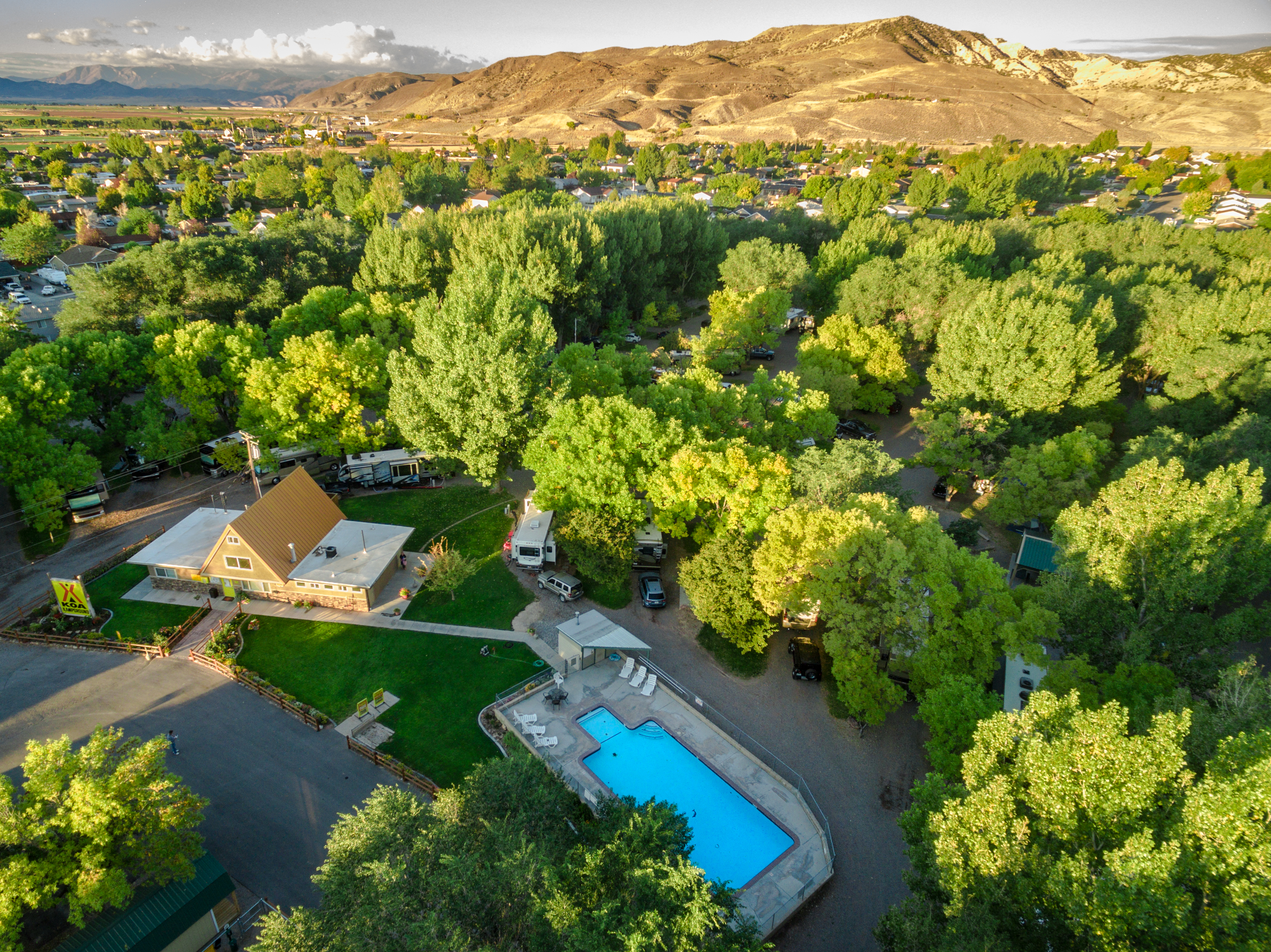
Zion River Resort RV Park & Campground
Zion River Resort
Zion River Resort is a lush oasis located beside the Virgin River, just 15 minutes from Zion National Park. It serves as an ideal base for exploring nearby natural attractions and offers a variety of camping options, excellent guest services, and ...
Twin Creeks Picnic
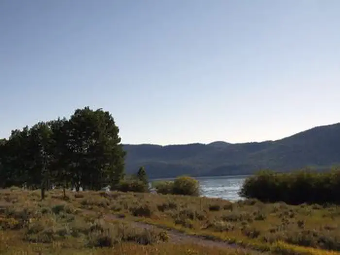
Twin Creeks Picnic Area is a day-use site at 8,800 feet near Fish Lake, offering activities like fishing, boating, and trail exploration. Visitors can view spawning salmon along a boardwalk in mid to late fall. Year-round fishing opportunities are...
Fruita Campground
Fruita Campground, located in Capitol Reef National Park, features 71 sites, with 65 available for year-round reservations. Certain sites are designated for administrative use, and some accessible sites offer electrical hookups. Generators are per...
Page Lake Powell Campground
Elkhorn Campground
Elkhorn Campground is situated 20 miles northeast of Loa, Utah, at an elevation of about 9,300 feet on Thousand Lake Mountain. It offers visitors access to scenic local trails for hiking, biking, and off-road vehicle exploration.
From $60/night
Bowery Creek
Bowery Creek Campground is situated by Fish Lake in Utah's Fishlake National Forest. It offers activities like boating, fishing, and trail exploration for visitors.
Kaibab Camper Village
Settlers Junction RV Park
Settlers Junction RV Park offers convenient I-15 access, making it the quickest route to Zion National Park and nearby attractions. The oversized sites ensure comfort and privacy, and the newly completed clubhouse provides various amenities. A tra...
Gateway Luxury RV Resort & Casitas
Frying Pan
Frying Pan Campground is situated along the Fishlake Scenic Byway in central Utah, 3 miles north of Fish Lake at an elevation of 9,000 feet. It offers opportunities for boating, fishing, and trail exploration.
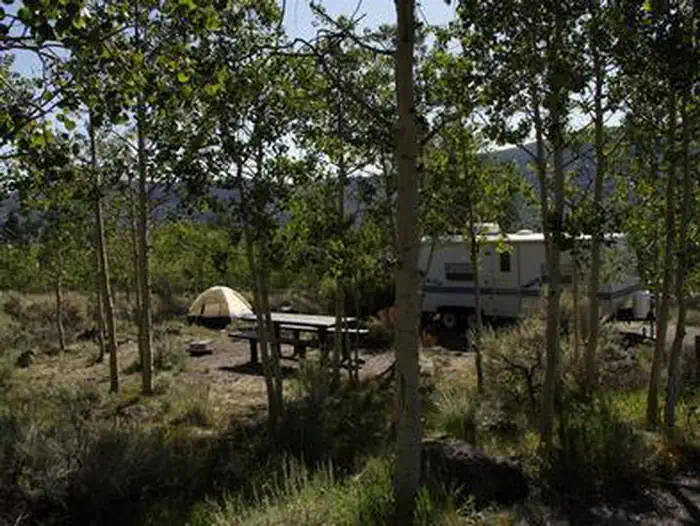
Paiute Campground
Paiute Campground, located 29 miles north of Loa, Utah, offers 48 pull-through sites at an elevation of 8,800 feet, making it suitable for large groups and individual campers. Situated near Johnson Reservoir in Fishlake National Forest, it provide...
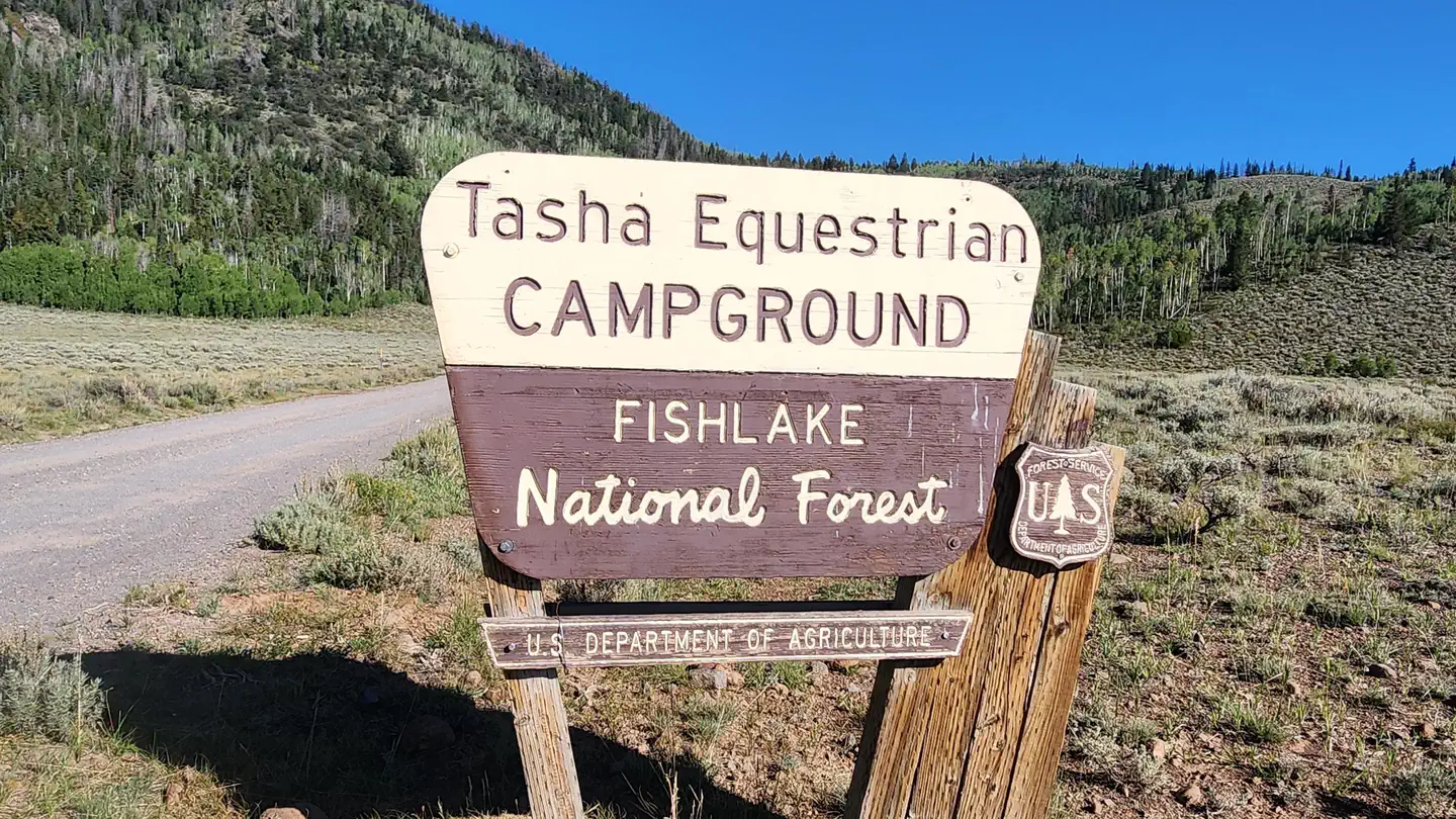
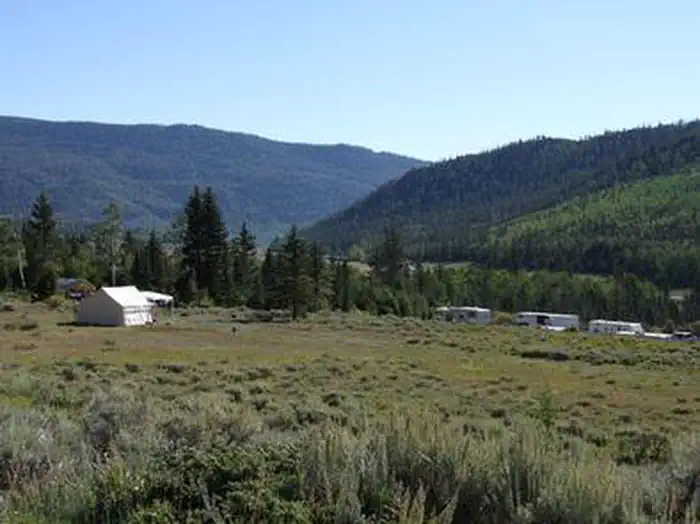
Tasha Equestrian
Tasha Equestrian Campground is situated in central Utah, 4 miles north of Fish Lake at an elevation of 9,000 feet. It offers activities such as horseback riding and fishing for Mackinaw lake trout.
WillowWind RV Park
WillowWind RV Park in Hurricane, Utah offers a blend of outdoor adventure and modern amenities, nestled among the stunning red rocks of Southern Utah. Guests can easily access attractions like Sand Hollow Reservoir and Zion National Park, with day...
Zion View RV Park
Zion View RV Park offers spacious full-hookup RV sites with various sizes and amenities, including high-speed Wi-Fi and a pet-friendly dog park. Guests can enjoy level concrete pads, picnic tables, and a community fire pit while taking in the beau...
Color Canyon RV Resort
Color Canyon RV Resort offers spacious full-hookup RV sites with various sizes and amenities, including picnic tables and ample room for relaxation. Guests can enjoy clean restrooms, hot showers, laundry facilities, high-speed Wi-Fi, a clubhouse, ...
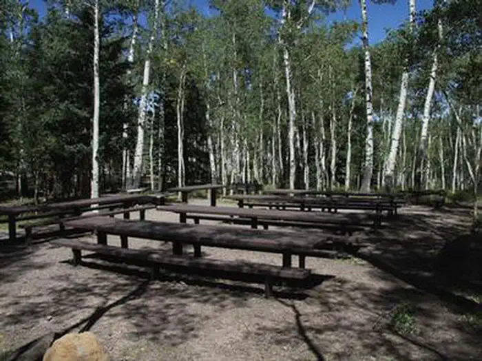
Pine Valley Recreation Area
Pine Valley Recreation Area is located in a scenic valley amid the Pine Valley Mountains, featuring campgrounds for families, large groups, and motorhomes. At 6,900 feet elevation, it provides a cool retreat from the Southern Utah desert heat. Vis...
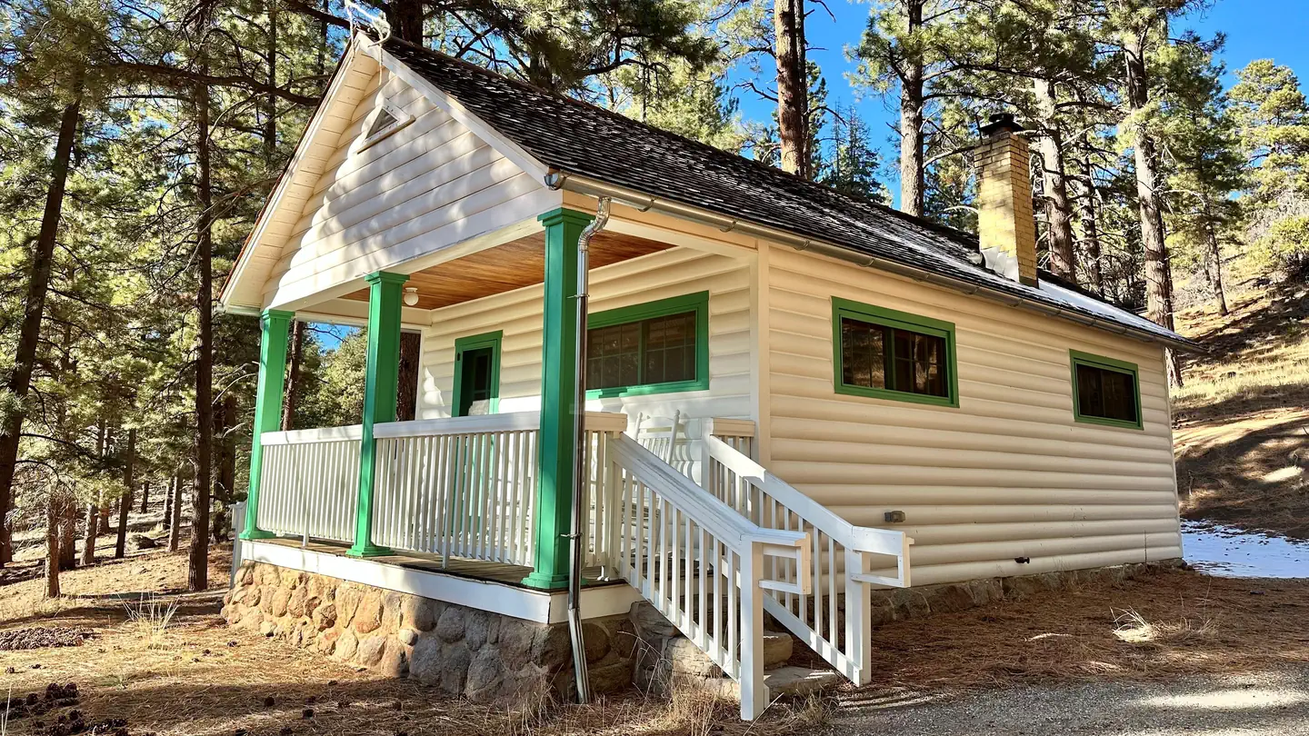
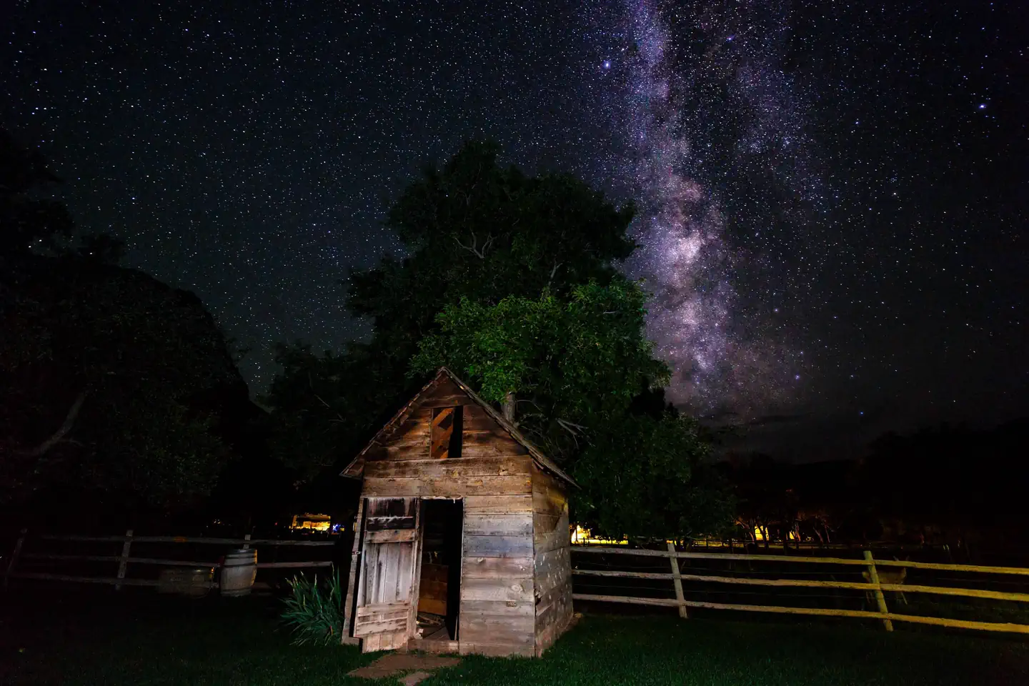
Pine Valley Guard Station
Pine Valley Guard Station, located in the scenic Pine Valley Recreation Area near St. George, Utah, was built in 1935 by the Civilian Conservation Corps to house a recreation guard. The cabin is accessible year-round, though winter access may requ...
Zions Gate RV Resort
Zions Gate RV Resort, located near Zions National Park in southern Utah, offers access to stunning canyons, hiking, and nearby golf and boating activities. The resort features amenities like a heated indoor pool, hot tub, clubhouse, and laundry fa...
Richfield KOA Holiday
Popular Filters
Zion River Resort RV Park & Campground
Zion River Resort
Zion River Resort is a lush oasis located beside the Virgin River, just 15 minutes from Zion National Park. It serves as an ideal base for exploring nearby natural attractions and offers a variety of camping options, excellent guest services, and ...
Twin Creeks Picnic
Twin Creeks Picnic Area is a day-use site at 8,800 feet near Fish Lake, offering activities like fishing, boating, and trail exploration. Visitors can view spawning salmon along a boardwalk in mid to late fall. Year-round fishing opportunities are...
Fruita Campground
Fruita Campground, located in Capitol Reef National Park, features 71 sites, with 65 available for year-round reservations. Certain sites are designated for administrative use, and some accessible sites offer electrical hookups. Generators are per...
Page Lake Powell Campground
Elkhorn Campground
Elkhorn Campground is situated 20 miles northeast of Loa, Utah, at an elevation of about 9,300 feet on Thousand Lake Mountain. It offers visitors access to scenic local trails for hiking, biking, and off-road vehicle exploration.
From $60/night
Bowery Creek
Bowery Creek Campground is situated by Fish Lake in Utah's Fishlake National Forest. It offers activities like boating, fishing, and trail exploration for visitors.
Kaibab Camper Village
Settlers Junction RV Park
Settlers Junction RV Park offers convenient I-15 access, making it the quickest route to Zion National Park and nearby attractions. The oversized sites ensure comfort and privacy, and the newly completed clubhouse provides various amenities. A tra...
Gateway Luxury RV Resort & Casitas
Frying Pan
Frying Pan Campground is situated along the Fishlake Scenic Byway in central Utah, 3 miles north of Fish Lake at an elevation of 9,000 feet. It offers opportunities for boating, fishing, and trail exploration.
Paiute Campground
Paiute Campground, located 29 miles north of Loa, Utah, offers 48 pull-through sites at an elevation of 8,800 feet, making it suitable for large groups and individual campers. Situated near Johnson Reservoir in Fishlake National Forest, it provide...
Tasha Equestrian
Tasha Equestrian Campground is situated in central Utah, 4 miles north of Fish Lake at an elevation of 9,000 feet. It offers activities such as horseback riding and fishing for Mackinaw lake trout.
WillowWind RV Park
WillowWind RV Park in Hurricane, Utah offers a blend of outdoor adventure and modern amenities, nestled among the stunning red rocks of Southern Utah. Guests can easily access attractions like Sand Hollow Reservoir and Zion National Park, with day...
Zion View RV Park
Zion View RV Park offers spacious full-hookup RV sites with various sizes and amenities, including high-speed Wi-Fi and a pet-friendly dog park. Guests can enjoy level concrete pads, picnic tables, and a community fire pit while taking in the beau...
Color Canyon RV Resort
Color Canyon RV Resort offers spacious full-hookup RV sites with various sizes and amenities, including picnic tables and ample room for relaxation. Guests can enjoy clean restrooms, hot showers, laundry facilities, high-speed Wi-Fi, a clubhouse, ...
Pine Valley Recreation Area
Pine Valley Recreation Area is located in a scenic valley amid the Pine Valley Mountains, featuring campgrounds for families, large groups, and motorhomes. At 6,900 feet elevation, it provides a cool retreat from the Southern Utah desert heat. Vis...
Pine Valley Guard Station
Pine Valley Guard Station, located in the scenic Pine Valley Recreation Area near St. George, Utah, was built in 1935 by the Civilian Conservation Corps to house a recreation guard. The cabin is accessible year-round, though winter access may requ...
Zions Gate RV Resort
Zions Gate RV Resort, located near Zions National Park in southern Utah, offers access to stunning canyons, hiking, and nearby golf and boating activities. The resort features amenities like a heated indoor pool, hot tub, clubhouse, and laundry fa...
Richfield KOA Holiday
Bryce, Utah
Find your perfect stay
The best deals for public & private campgrounds
Check availability & reserve your stay directly
Protect yourself from severe weather events
Frequently Asked Questions
Most destinations offer a variety of accommodations including tent sites, RV sites, cabins, yurts, and glamping options. Check individual property listings for specific amenities and site types.
The best time to visit depends on your preferences and planned activities. Spring and fall typically offer mild weather and fewer crowds, while summer is peak season with the warmest temperatures. Winter visits can be great for those seeking solitude and winter activities.
We highly recommend making reservations in advance, especially during peak season (summer months and holidays). Popular destinations can book up weeks or even months ahead. Last-minute bookings may be available during off-peak times.
Pet policies vary by property. Many campgrounds welcome pets but may have restrictions on size, breed, or number of pets. Some properties charge additional pet fees. Always check the specific property's pet policy before booking.
Essential items include a tent or RV, sleeping bags, cooking equipment, food and water, appropriate clothing for the weather, first aid kit, flashlight, and any specific gear for planned activities. Check the property's amenities to see what's provided and what you'll need to bring.
Nearby destinations
List your Campground, RV Park or Resort near Bryce on OutReserve
Do you own a campground or RV park near Bryce? List on OutReserve and connect with thousands of outdoor enthusiasts looking to stay in the area.
Free to List
Listing is completely free. You only pay a small commission when you receive a booking: no upfront costs, no hidden fees.
Reach Thousands
Connect with thousands of outdoor enthusiasts actively searching for their next camping adventure. Grow your bookings year-round.
Get Paid Fast
Receive payouts directly to your bank account after each stay. Fast, secure, and reliable so you can focus on your guests.