

Available sites
33 total sites Tent Sites
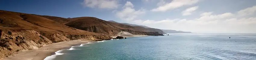
About Santa Rosa Island Backcountry Beach Camping
Seasonal information
2026 Season availability
Open year round
This campground is open year round, providing flexibility for your stay.
Campground Amenities
Most popular amenities
 Pet friendly

On Site Services
- Fish Cleaning Station

Water Access
- Beach Access
- Boat Ramp / Launch

Pets and Policies
- Pet friendly
Rates, Sites & Availability
33 Sites Available
No sites found matching your criteria.
No available sites
All sites are booked for your selected dates. Try showing all sites to see booked options, create an alert to be notified when something opens up, or adjust your dates.
Site Details
Select a site to view details
33 Sites Available
No available sites
All sites are booked for your selected dates. Try showing all sites to see booked options, create an alert to be notified when something opens up, or adjust your dates.
Reviews (72)
What Guests Are Saying
Santa Rosa Island's backcountry camping offers a serene and secluded experience, with stunning views, beautiful sunrises, and encounters with wildlife like elephant seals and sea birds. The trek to campsites, particularly at Ford Point and Officers Beach, requires careful planning and navigation due to elevation changes and trail difficulties, but many find it rewarding. While some challenges exist, such as limited signage and beach access issues, the overall tranquility and beauty of the location make it a memorable camping destination.
Review Summary
Lynn L
VerifiedAugust 27, 2024 • Stayed at: Southeast Quadrant Dispersed Camping, Loop: Southeast Quadrant Dispersed Camping
August 17th, 2024. Last winter's strong storms, heavy rains and huge surf coinciding with high tides have taken a toll on the South-facing beach which is designated for camping. The large dune and elevated portion of the beach sand along with the beach verbena and ice plant have been swept away leaving a nearly vertical sandy entrance at the back of the beach. It would be nearly impossible to exit the beach this way due to the steepness of the sand grade. However, at low and medium tides (2.5 ft and below) it is possible to enter and exit the beach via the solid rock surface on the East side of the beach. The white rock path down to the beach is steep and sharp with embedded conglomerate stones. The entire lower beach was flooded by a high 6-foot tide, so bring a tide chart. That said, there are still some beach sand spots available for camping on the elevated stone at the back of the beach, but the sand has a slope and it is exposed to strong winds. Anchor tent firmly with sandbags and enjoy the beautiful beaches.
Cynthia S
VerifiedNovember 22, 2024 • Stayed at: Southeast Quadrant Dispersed Camping, Loop: Southeast Quadrant Dispersed Camping
Signage was non existent in a few areas. There needs to be a sign to assist in getting you to the beach campsite. We could not find a way down to the beach (east point) The trail pn the way up to the ridge was difficult to find and follow.
J William D
VerifiedAugust 27, 2025 • Stayed at: Southeast Quadrant Dispersed Camping, Loop: Southeast Quadrant Dispersed Camping
The ruck out to Ford Point from the pier is about 11.5 mi via South Road (rather than the 10.5 mi that physical maps and Google maps suggest.) Once you hit the Ford Point sign just past the old ranch house on Water Canyon Ave, there is no groomed trail. You will have to navigate down to the plateau yourself, but you should be able to see where others have come before. If you want to get down to the one camping spot on the beach, that brings it closer to 12 mi.
The plateau has a great view of the ocean and the sunrise. Personally, I had to break down my campsite and move it to an alcove on the beach to avoid some high winds blowing all my stuff away. To get down to the beach, there is a small canyon just north of the end of Ford Point Road. It's a bit of a scramble, with a couple of small drop-offs, but it's doable. You should be able to make out where others have trod before.
If you want to camp on the beach, there is only one spot safe from high tide. It's about 3/4 of the way to the rocky outcropping; you should be able to see the alcove on Google Maps, as it pushes back into a canyon a little. It's the perfect size for one or two people to stake out a spot, but no more than that. Most of the elephant seals appear to spend their time on the other side of the rocky outcropping, so you shouldn't have to worry about them. Occasionally, a couple of juveniles will make their way over to play in the surf, but that's it. It's very peaceful as very few people seem to make it out there. I stayed two nights and didn't see a soul the second day I was there.
Jason G
VerifiedOctober 13, 2025 • Stayed at: Southeast Quadrant Dispersed Camping, Loop: Southeast Quadrant Dispersed Camping
We did some backcountry camping at Ford Point and Officers Beach. Lots of planning is required and it’s a long walk with a lot of elevation change from the pier, but it was totally worth it. Elephant seals, sea birds, beautiful sunrises and sunsets, and total seclusion
Elias H
VerifiedOctober 17, 2025 • Stayed at: Northwest Quadrant Dispersed Camping, Loop: Northwest Quadrant Dispersed Camping
This was one of the most incredible camping experiences f my life and I can't wait to go back. Bring water AND a filter!!
Elias H
VerifiedOctober 17, 2025 • Stayed at: Northwest Quadrant Dispersed Camping, Loop: Northwest Quadrant Dispersed Camping
This was one of the most incredible camping experiences f my life and I can't wait to go back. Bring water AND a filter!!
Location & Directions for Santa Rosa Island Backcountry Beach Camping
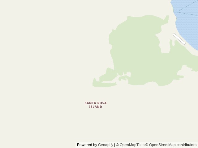
1901 Spinnaker Drive, Ventura, CA 93001 United States
Elevation: 316 ft
Getting There
Backcountry campers must first secure transportation to Santa Rosa Island by their own private boat or through Island Packers or Channel Islands Aviation the park's authorized concessioners.
Highway access
The campground is accessible via US Highway 101, which is approximately 20 miles to the east.
Nearby National Park
In Channel Islands National Park
Approximate driving time: 7 min
Policies & Rules
Arrival & departure
Check in time
11AM
Check out time
11AM
General
- Reservations Required. Advance reservations are mandatory. There are no walk-ups.
- Camping Maximum. Ten groups per night, per quadrant. Max 4 campers per group. One party or group may reserve a maximum of 2 sites per visit.
- Transportation to the Island. You must arrange transportation to Santa Rosa Island before making a campsite reservation. Please read 'Getting There.'
- Bring Extra Supplies. Bring supplies and food for an extra day in case the boats are unable to pick up campers due to weather conditions.
- Backpack to Beach Camping Areas. Visitors must backpack to and from their dispersed campsites and must carry their own gear, food and water. The minimum hiking distance from the Bechers Bay Pier to an approved beach camping area is 7 miles (5.5 miles when all quadrants are open and with good conditions). Campers should be prepared to hike 10+ miles on their first and last day in the backcountry.
- Water & Water Treatment. The park recommends carrying one gallon of water per person per day. Potable water is available in the Water Canyon (frontcountry) campground. Outside the Water Canyon campground, water sources may be unreliable or contaminated. Please read the water and water treatment information under 'Facilities.'
- Camp Only on Beaches. Camping is prohibited in any other areas, including dunes and coastal bluffs. Beach camping areas can fill (dry/usable space is limited and may be occupied by wildlife), many beaches are not accessible from land (cliffs), or do not have established/obvious trails to or from. Please read the additional details under 'Facilities,' above.
- Proper food and trash storage is required. Recommend hard-sided container (i.e., bear canister) to further protect food/garbage from animals.
- Pack In, Pack Out. Visitors are required to pack out what they pack in, including garbage and human waste in the backcountry. 'Waste bags' are available from outdoor suppliers. Strain or separate food particles from cooking water and pack them out. Scatter the gray water 200 ft. from water sources and camps.
- No Campfires. No campfires or charcoal fires. Only enclosed gas camp stoves. Stoves only in authorized beach camping areas.
- Smoking. Smoking is only allowed on beach areas far from ignition sources.
- Hantavirus. Avoid contact with deer mice. Hantavirius has been found in island deer mice.
- Biosecurity. To help prevent the introduction of nonnative species the following items may not be brought to the park: pets; live or potted plants; soil; cut flowers; firewood or any untreated, unfinished wood (including hiking sticks); corrugated boxes; tools or equipment with attached soil; motorized vehicles; bicycles; and single-use plastic grocery bags. Prior to departure, visitors are required to use pest-proof packing materials, inspect and clean their gear and shoes of all soil, seeds, and insects. Learn more about biosecurity and watch the required video at Protect Your Park Through Biosecurity.
- Fishing. No fishing in marine reserves. A California fishing license and ocean enhancement required to fish within Channel Islands National Park.
- Watersports. Due to the strong, persistent wind, swimming, snorkeling, diving, and kayaking are limited and recommended for the experienced visitor only. Ocean conditions can rapidly change, requiring expert abilities. Ocean kayaking is an inherently dangerous activity. Always check weather and do not kayak beyond your experience level.
- Important Closures. Avoid closed areas to protect island resources. Island closures include but are not limited to:Sandy Point - No camping or beach access.Skunk Point - Travel on wet sand only. No camping.China Camp and Cluster Point - No camping or beach access. Areas around China Camp and Cluster point are restricted to on trail travel only. Follow route and closure signs in area.Lobo Canyon - No camping. Area is restricted to on trail travel only. Follow route and closure signs in area.
- Everything is Protected As in all national parks, it is illegal to feed, collect, disturb, or harm park wildlife, plant life, or other natural, historical, and archeological features. Taking from or disturbing archeological sites or artifacts is a violation of state and federal law. The archeological sites around the Channel Islands are a testament to the importance of the Chumash and other American Indians. Archeological sites are sacred to Chumash peoples today, are protected by federal law, and are a vital nonrenewable scientific resource. Please help us in protecting and preserving this rich part of California’s heritage. Additional Information. Please visit Backcountry Beach Camping: Santa Rosa Island on the Channel Islands National Park website for more information.
Nearby Campgrounds


Nearby destinations
Last updated: October 22, 2026

Need help?
Our team is here to help you find the perfect spot for your next adventure.
Replies within minutes
Explore Ventura, CA
Nearby city: Santa Barbara, CA
Approx. 38 mi away (straight-line distance)
Elevation: 36 ft
From our Travel Guides