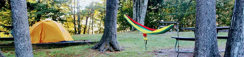


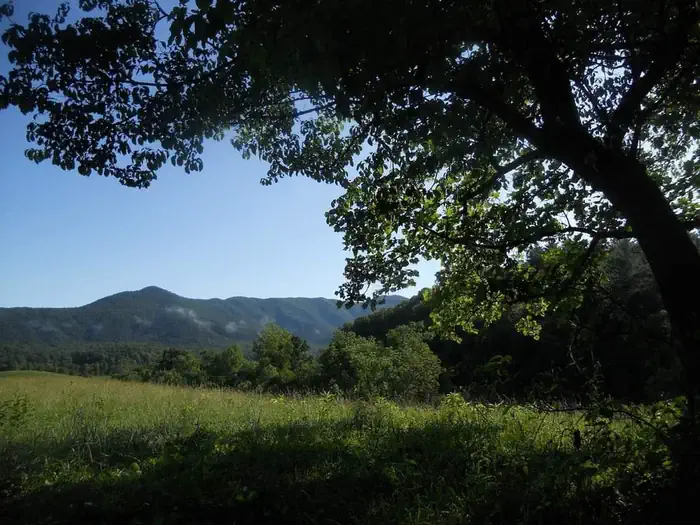
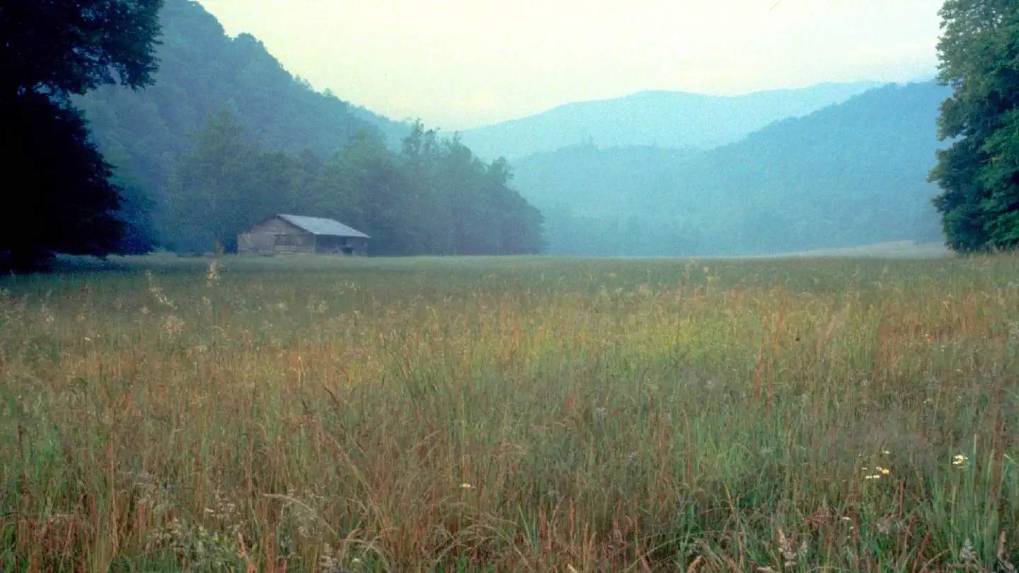
About Balsam Mountain Campground
Number of accommodations: 42
Seasonal information
2026 Season availability
Campground Amenities
Most popular amenities
 Parking
 Restrooms
 Fire Pit

Water and Hygiene
- Potable Water
- Restrooms

Cooking and Fire
- Fire Pit
- Campfire Ring

Parking and Transport
- Parking
Report Incorrect Information
Help us improve by reporting any incorrect amenity information for Balsam Mountain Campground.
Rates, Sites & Availability
42 Sites Available
No sites found matching your criteria.
No available sites
All sites are booked for your selected dates. Try showing all sites to see booked options, create an alert to be notified when something opens up, or adjust your dates.
Site Details
Select a site to view details
42 Sites Available
No available sites
All sites are booked for your selected dates. Try showing all sites to see booked options, create an alert to be notified when something opens up, or adjust your dates.
Reviews (680)
What Guests Are Saying
Balsam Mountain Campground offers beautiful, well-maintained sites with plenty of wildlife and hiking opportunities, making it a perfect escape from summer heat. Many visitors appreciate the friendly hosts and clean facilities, while the atmosphere is described as quiet and serene. Although some sites may feel close together and there are occasional issues with amenities like firewood, the overall experience is highly praised, with many returning annually for its charm and natural beauty.
Review Summary
William G
VerifiedSeptember 7, 2021 • Stayed at: 29, Loop: BALSAM MOUNTAIN CAMPGROUND
I camped in the tents-only section of the campground for 4 nights near the end of August. It is true that the tent pads are close together and everyone can hear everyone else when talking at normal volume, but most car-camping campgrounds are like this to some extent. The most secluded tent pad is #29, but therefore it is the farthest from the parking lot. The tent area is across the road from the restrooms at the end of the campground road, so there is no passing traffic. Each tent site has a bear box of its own.
Many of the popular hiking trails are in other sections of the park, such as the Charlies Bunion trail that begins at the Newfound Gap overlook. The most popular trail near Balsam Mountain Campground seems to be Hemphill Bald trail that begins at Polls Gap, which you must pass on the way to the campground. To make a fire in the fire pit, you will need to bring in your own (treated) wood, tinder, and kindling (or fire starters). In August, all of the wood to be found in the surrounding forest was too wet to burn.
Google Maps shows Heintooga Round Bottom Rd, also labeled as Balsam Mountain Rd., running north-northwest beginning at the loop at the end of the paved road labelled "Heintooga Overlook" ("Round Bottom Picnic Area" on the campground map; not present on the official park map). This is actually a one-way, unpaved road that forms a long loop that eventually brings you out to US 441 near the Osonaluftee Visitor Center. Google Maps made one of its classic errors getting me back to the campgound, leading me over a steep, unpaved remote road across a mountain. This was the first time my Subaru Outback's all-wheel-drive system has ever been useful. Overall, you will need to refuse some of Google Map's suggested routes. A paper map would have come in handy.
DOUGLAS C
VerifiedSeptember 5, 2021 • Stayed at: 35, Loop: BALSAM MOUNTAIN CAMPGROUND
Nice, secluded mountain getaway
DOUGLAS C
VerifiedSeptember 5, 2021 • Stayed at: 35, Loop: BALSAM MOUNTAIN CAMPGROUND
Nice, secluded mountain getaway
Young L
VerifiedSeptember 4, 2021 • Stayed at: 39, Loop: BALSAM MOUNTAIN CAMPGROUND
The bathrooms were very clean and the hosts were very kind…..great place to camping.^^
Young L
VerifiedSeptember 4, 2021 • Stayed at: 39, Loop: BALSAM MOUNTAIN CAMPGROUND
The bathrooms were very clean and the hosts were very kind…..great place to camping.^^
Sharad S
VerifiedSeptember 2, 2021 • Stayed at: 30, Loop: BALSAM MOUNTAIN CAMPGROUND
Nice secluded campground up in the hill. The facilities are clean and well maintained. The campsites are very close, though we got lucky as there were not many campers during our stay, else would have felt too crowded.
Tom P
VerifiedSeptember 2, 2021 • Stayed at: 27, Loop: BALSAM MOUNTAIN CAMPGROUND
clean tent only sites and clean restrooms
Location Balsam Mountain Campground
Address:
253 Smokemont Campground Road
Cherokee, NC, 28719
United States
From the North: From I-40 take Exit 20 Maggie Valley, NC and travel US-19 towards Cherokee, NC. Access the Blue Ridge Parkway at Soco Gap and continue South to mile 458.2, turning right onto Heintooga Ridge Road. Enter Great Smoky Mountains National Park at Black Camp Gap and continue 9 miles to Balsam Mountain Campground. From the South: Follow US-441/US-23 North. At Dillsboro merge onto US-74 West/US-441 North. At exit 74 merge onto US-441. Continue on US-441 through Cherokee, NC and into the park. Access the Blue Ridge Parkway traveling North to mile 458.2, turning left onto Heintooga Ridge Road. Enter Great Smoky Mountains National Park at Black Camp Gap and continue 9 miles to Balsam Mountain Campground.
Balsam Mountain Campground is accessible via I-40, US-19, US-441, and the Blue Ridge Parkway. I-40 is approximately 20 miles to the north, with access via Exit 20 to US-19. US-441 also provides access through Cherokee, NC.
Latitude & Longitude: 35.5654 / -83.1743
Elevation: 1633 feet
Nearby National Park
Arch Rock Entrance
Approximate driving time: 54 min
Nearby Campgrounds
Nearby destinations
Last updated: July 11, 2026