

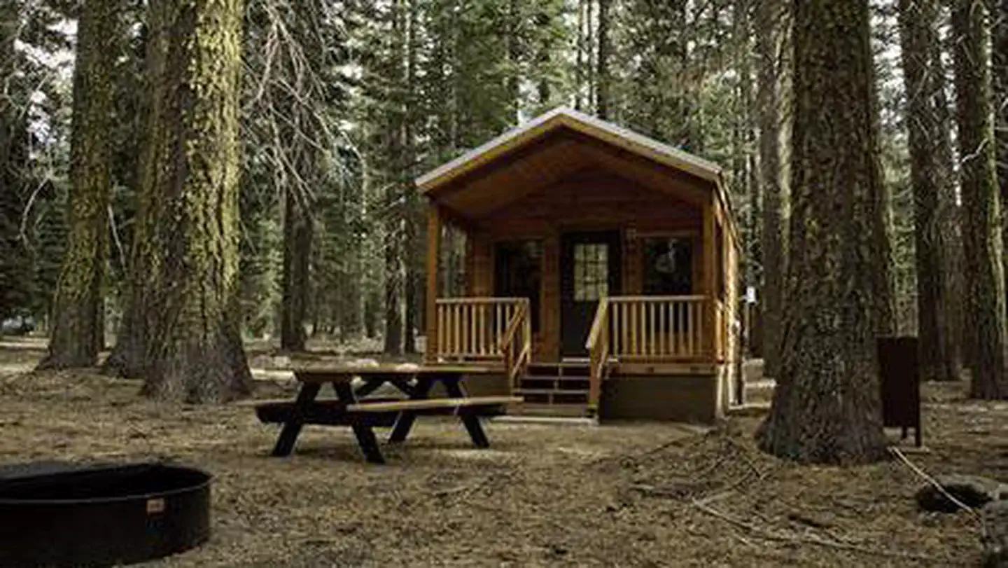
Sites & Rates
8 total sites · $62.00 avg/night
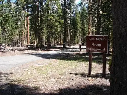
About Lost Creek Group
Number of accommodations: 8
Seasonal information
2026 Season availability
Campground Amenities
Most popular amenities
 Picnic Table
 Restrooms
 Fire Pit

Water and Hygiene
- Potable Water
- Restrooms

Cooking and Fire
- Picnic Table
- Fire Pit

Water Access
- Boat Ramp / Launch
Report Incorrect Information
Help us improve by reporting any incorrect amenity information for Lost Creek Group.
Rates, Sites & Availability
8 Sites Available
No sites found matching your criteria.
No available sites
All sites are booked for your selected dates. Try showing all sites to see booked options, create an alert to be notified when something opens up, or adjust your dates.
Site Details
Select a site to view details
8 Sites Available
No available sites
All sites are booked for your selected dates. Try showing all sites to see booked options, create an alert to be notified when something opens up, or adjust your dates.
Reviews (32)
What Guests Are Saying
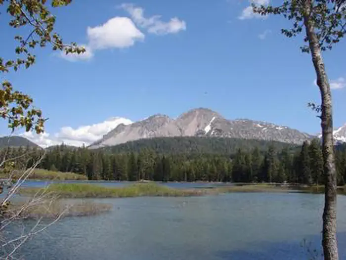
Visitors to Lassen Volcanic National Park appreciate the stunning views, unique geological features, and peaceful hiking trails, especially during less crowded times. Despite some inconveniences, such as road closures and the impacts of the 2021 Dixie fire, many expressed a desire to return for a more comprehensive experience, including hiking deeper into the park. Overall, the park's beauty and spacious campsites near Manzanita Lake were highlighted positively.
What Guests Are Saying
Visitors to Lassen Volcanic National Park appreciate the stunning views, unique geological features, and peaceful hiking trails, especially during less crowded times. Despite some inconveniences, such as road closures and the impacts of the 2021 Dixie fire, many expressed a desire to return for a more comprehensive experience, including hiking deeper into the park. Overall, the park's beauty and spacious campsites near Manzanita Lake were highlighted positively.
Review Summary

Joe Joe H
November 13, 2025
We went on Nov. 3 only to find out the road to the park was closed to vehicles. Possibly due to snow and rock slides. Nevertheless, we tried to enjoy whatever we could get access to like the Sulphur works. Got some nice pictures. We would like to visit again in the spring and fully enjoy what the park has to offer.

A Richardson
November 11, 2025
Traveling back home in Southern Oregon, we made a special trip to drive through Lassen Volcanic National Park. It was sad to see how much the 2021 Dixie fire took out. Large areas are still recovering and I can only imagine that in its restored state, it would be beautiful. We only had time to drive through the park and check out a few scenic spots. I really appreciated that each pullout/attraction is numbered, making it easy to follow along on the map. Unfortunately, the Government shutdown was going on when we visited and we couldn’t visit any of the visitor centers. We would like to come back and do some of the hikes deeper into the park to get the full experience.

Catherine Hunt
November 10, 2025
This was our first time in Lassen Volcanic National Park. We visited in mid-October during the government shutdown. On our first day, we learned that Lassen Volcanic National Park Highway was closed to vehicles except for some workers. We were told that it was due to rock slides. It rained/snowed the day before. Of course, this didn’t stop my husband to explore the park when we learned that we were allowed to walk the highway and the trails. We decided to walk to Bumpass Trailhead to Bumpass Hell. We only met 3 visitors during our visit and we were the only ones walking the highway. We walked around 14 miles and exhausted since it was uphill (~5 miles) to Bumpass Trailhead. The views were amazing and rewarding which made the hike worthwhile. On our second day, we were relieved that the Lassen Volcanic National Park Highway was opened later in the morning. The view along the way was beautiful & it was ~30 miles to the other end (North Entrance) we hiked around Manzanita Lake.

Zoe Littmann
October 6, 2025
Beautiful park with various sights to check out and enjoy! Lots of hiking trails. It wasn’t busy when we went which was lovely. So many unique features that we appreciated! If you get the opportunity to go during summer or early fall, definitely check it out!

Jonathan Sullivan
September 29, 2025
One of the least populated parks I've been to but then, it was also seniors' September. Quiet trails at higher elevations and plenty of geological history. Didn't find an NP humor embedded anywhere.
Massiel D
VerifiedJuly 12, 2025 • Stayed at: 002, Loop: Lost Creek Group Sites
Beautiful place with 2 fire pits, toilet, and water available on site.
Massiel D
VerifiedJuly 12, 2025 • Stayed at: 002, Loop: Lost Creek Group Sites
Beautiful place with 2 fire pits, toilet, and water available on site.
Massiel D
VerifiedJuly 12, 2025 • Stayed at: 002, Loop: Lost Creek Group Sites
Beautiful place with 2 fire pits, toilet, and water available on site.
Francisco B
VerifiedJuly 6, 2025 • Stayed at: 004, Loop: Lost Creek Group Sites
Awesome , super spacious campsite very nicely located not far from manzanita lake and a bit into the park such that you’re not so far from the major hits.
Francisco B
VerifiedJuly 6, 2025 • Stayed at: 004, Loop: Lost Creek Group Sites
Awesome , super spacious campsite very nicely located not far from manzanita lake and a bit into the park such that you’re not so far from the major hits.
Location Lost Creek Group
Address:
Lassen Volcanic Np Po Box 100
Mineral, CA, 96063
United States
From Redding, California drive 48 miles east on State Highway 44 to State Highway 89. Turn right into Lassen Volcanic National Park and continue five miles south to Lost Creek Group Campground. It is 1/8-mile south of Crags Campground.
Lost Creek Group Campground is accessible via State Highway 44 and State Highway 89. It is located approximately 48 miles east of Redding, California, on State Highway 44.
Latitude & Longitude: 40.5625 / -121.517
Elevation: 1711 feet
Policies & Rules
General
- Campsites can accommodate a minimum of 10 to a maximum of 25 people and up to 6 cars or 1 bus/RV per site.
- An entrance fee of $30 per vehicle is required. Campers must have valid park entrance permit or pass before camping. We highly recommend purchasing a digital entrance permit through rec.gov.
- There are no electricity, water or sewer hookups
- There are no flush toilets; vault toilets only
- Please have a printed copy of your reservation with you.
- Pets are not allowed on trails and must be on a 6-ft. leash
Nearby Campgrounds
Nearby destinations
Last updated: July 11, 2026