


About Cedro Peak Camping Sites - Robin and Jay
Activities & Attractions
Nearby

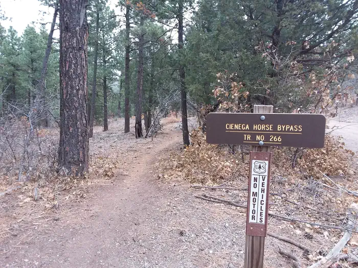
Hiking
Year-round
Hiking
Seasonal information
2026 Season availability
Reviews (18)
What Guests Are Saying
Cedro Peak Camping Sites are highly praised for their well-maintained and convenient facilities, making them ideal for large groups. The campground's beautiful setting and accessible paved paths enhance the experience for those using mobility aids. However, some guests noted issues with locked restrooms, which detracted from their overall satisfaction.
Review Summary
Cristina M
September 15, 2025
Cedro Peak camp sites are an absolute treasure. The sites are so convenient, always well kept, and perfect for a large group. I only wish they were open for more months during the year.
Cristina M
September 15, 2025
Cedro Peak camp sites are an absolute treasure. The sites are so convenient, always well kept, and perfect for a large group. I only wish they were open for more months during the year.
Sean C
November 15, 2024
The campground was beautiful, the paved paths were level enough for myself and my friends to use mobility aid wheelchairs, and powerchair.
The fire pits and grills were well made and perfect for our needs.
Thank you so much.
Sean C
November 15, 2024
The campground was beautiful, the paved paths were level enough for myself and my friends to use mobility aid wheelchairs, and powerchair.
The fire pits and grills were well made and perfect for our needs.
Thank you so much.
Stephen B
June 1, 2024
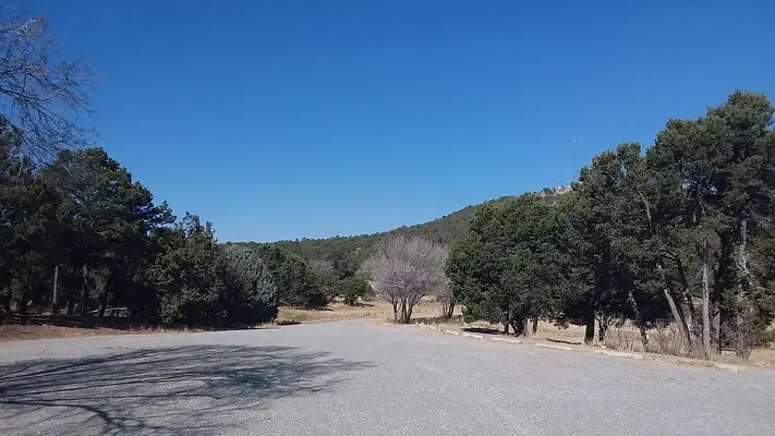
The campsite was nice and roomy. The covered area with the picnic tables was great. The location in the mountain area was not too far from the interstate highway.
I would have given it a very high rating but for one inexplicable reason - the restrooms were locked. You would think their locks would have accepted the same code as the entry gate (that was provided with the reservation).
Stephen B
June 1, 2024
The campsite was nice and roomy. The covered area with the picnic tables was great. The location in the mountain area was not too far from the interstate highway.
I would have given it a very high rating but for one inexplicable reason - the restrooms were locked. You would think their locks would have accepted the same code as the entry gate (that was provided with the reservation).
Gregory D
October 12, 2023
Made the reservation back in July for the Balloon Fiesta.
Drove down from Denver on Sunday (day of reservations) and got the the site a little after 8pm. Tried the lock code emailed to me, on both of the locks on the gate. But didn't work on either one. Called the number on the site, and it just went to voicemail.
We reached out to chat support on recreation.gov, they didn't have a lock code, and told me to call the number, that we already called. Since they didn't have a solution, they requested a refund on their end.(got the email conformation)
72 Hours after recreation.gov requested a refund i still haven't heard anything, and the request is still pending, on my reservation.
We ended up having to back track, an hour to the nearest rest area, and car camping for the night. Then found new accommodations the next day, for the remainder of the trip. Currently out the reservation cost plus the extra 120 miles of driving.
Cub Scout P
October 23, 2022
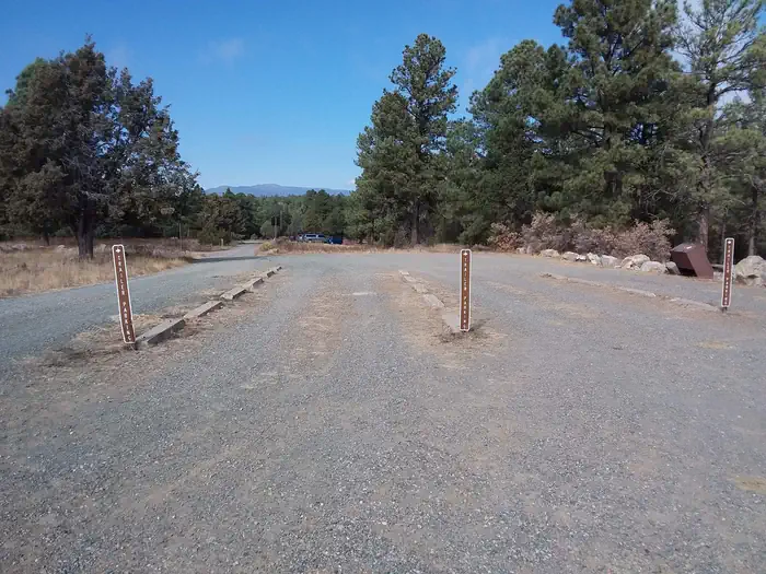
Great site, wonderfully maintained at an excellent cost. Obviously power and potable water would be nice to have. It was perfect for our Cub Scout weekend campout. Plenty of parking, open space for tents, and close enough to ABQ to be convenient if things are forgotten.
Cub Scout P
October 23, 2022
Great site, wonderfully maintained at an excellent cost. Obviously power and potable water would be nice to have. It was perfect for our Cub Scout weekend campout. Plenty of parking, open space for tents, and close enough to ABQ to be convenient if things are forgotten.
Location Cedro Peak Camping Sites - Robin and Jay
Address:
Sandia Ranger District
Tijeras, NM, 87059
United States
From Albuquerque, drive east on I-40 to Exit 175. Drive south for approximately 4 miles on State Highway 337 (also known as, James McGrane Memorial Highway). Look for the Juan Tomas/242 sign on the east side of the road. Turn left and follow the road until you reach Forest Road 252. Turn left and follow the road for about one mile. Follow the directional signs at the entrance, to Cedro Peak Camping Sites - Robin and Jay.
From the east (Edgewood area) use Exit 175 off I-40. At the bottom of the ramp turn left and go to the light. Turn right at the light. You are now on 333/Old Route 66. Continue until you reach the light at the intersection of State Road 333/66 and State Road 337. Turn left and continue on State Highway 337 for approximately 4 miles on State Highway 337 (also known as, James McGrane Memorial Highway). Look for the Juan Tomas/242 sign on the east side of the road. Turn left and follow the road until you reach Forest Road 252. Turn left and follow the road for about one mile. Follow the directional signs at the entrance, to Cedro Peak Camping Sites - Robin and Jay.
Cedro Peak Camping Sites is accessible via Interstate 40, with Exit 175 providing access to State Highway 337 (James McGrane Memorial Highway), which is approximately 4 miles from the exit.
Latitude & Longitude: 35.0331 / -106.35
Elevation: 2168 feet
Policies & Rules
General
- To ensure an enjoyable stay for the next visitor, please make sure to place ALL trash in the trash cans provided and leave the site as clean as you found it.
- Water and electricity, firewood/charcoal are not available at the site. You may notice water spigots at this site, however the water lines were retired in the mid 2000s due to difficulties with freezing pipes, therefore, bring your own water.
- Accessible vault toilets and bear proof trash receptacles are provided. Please use appropriate containers for food and garbage. Food Storage Keeping You and Bears Safe More about Bears and Food
- Please DO NOT park in front of any gates. They must be accessible at all times.
- Have questions? Call the Sandia Ranger District Office, Monday through Friday between 8 a.m. and 4:30 p.m. at (505) 281-3304.
- Prevent Bug Kill. Obtain firewood near your destination and burn it on-site: Don't Move Fire Wood
- For more information about the Cibola National Forest & Grasslands: Cibola National Forest Web Page
- Trail Map: Manzanita Mountains Trail Map
Nearby Campgrounds
Nearby destinations
Last updated: July 11, 2026