Top Campgrounds near La Verkin
Popular Filters
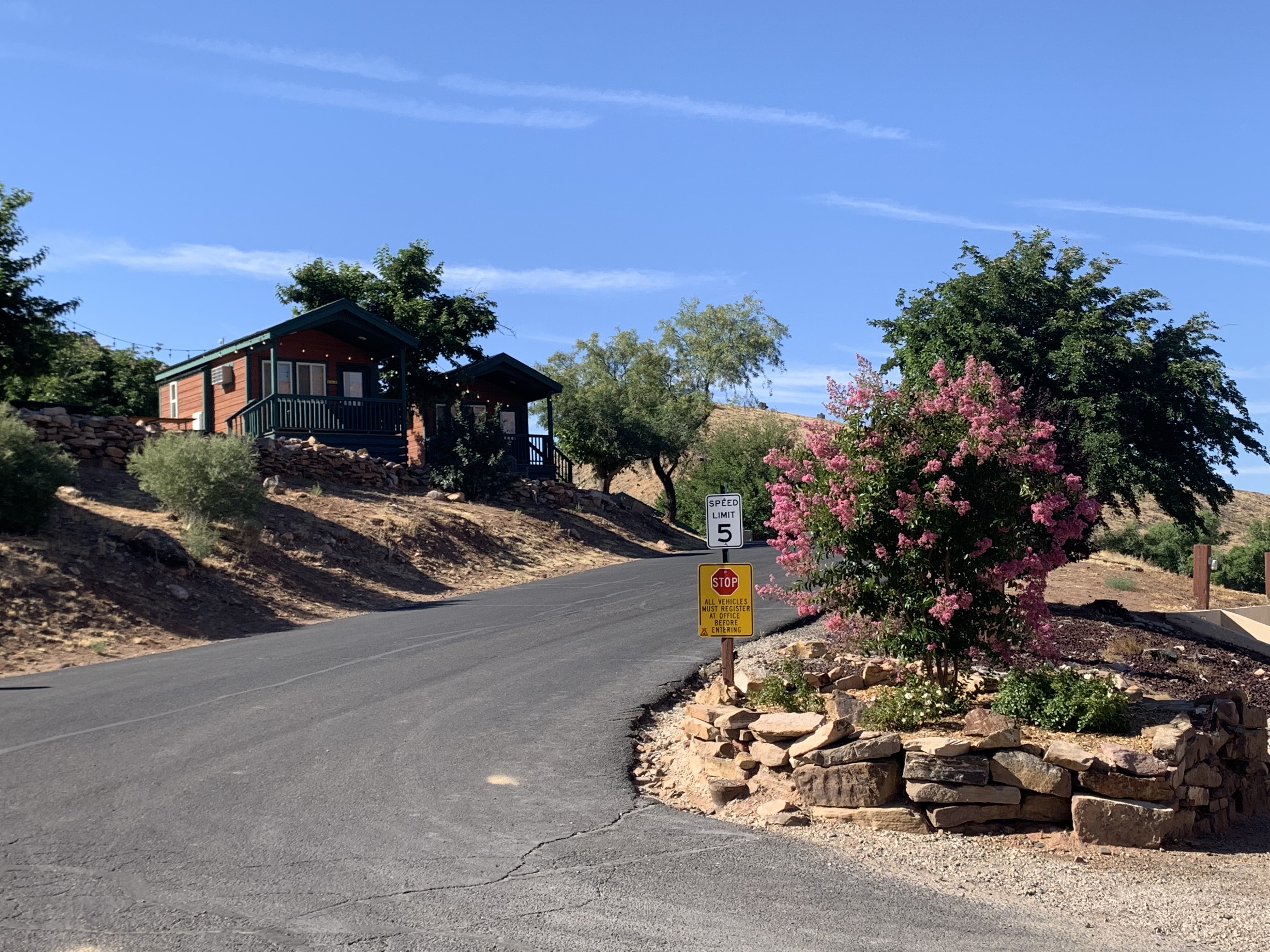
Gateway Luxury RV Resort & Casitas
WillowWind RV Park
WillowWind RV Park in Hurricane, Utah offers a blend of outdoor adventure and modern amenities, nestled among the stunning red rocks of Southern Utah. Guests can easily access attractions like Sand Hollow Reservoir and Zion National Park, with day...
Zion View RV Park
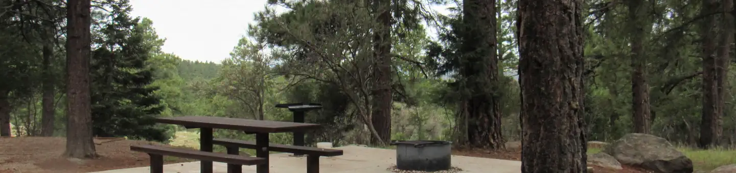
Zion View RV Park offers spacious full-hookup RV sites with various sizes and amenities, including high-speed Wi-Fi and a pet-friendly dog park. Guests can enjoy level concrete pads, picnic tables, and a community fire pit while taking in the beau...
Color Canyon RV Resort
Color Canyon RV Resort offers spacious full-hookup RV sites with various sizes and amenities, including picnic tables and ample room for relaxation. Guests can enjoy clean restrooms, hot showers, laundry facilities, high-speed Wi-Fi, a clubhouse, ...
Zion River Resort
Zion River Resort is a lush oasis located beside the Virgin River, just 15 minutes from Zion National Park. It serves as an ideal base for exploring nearby natural attractions and offers a variety of camping options, excellent guest services, and ...
Zion River Resort RV Park & Campground
Zion Vacation Village
Zion Vacation Village is a newly established campground located 12 miles from Zion National Park, combining comfort with adventure in a scenic valley. Guests can enjoy modern accommodations, including cabins and RV sites, along with top-tier ameni...
Settlers Junction RV Park
Settlers Junction RV Park offers convenient I-15 access, making it the quickest route to Zion National Park and nearby attractions. The oversized sites ensure comfort and privacy, and the newly completed clubhouse provides various amenities. A tra...
Zions Gate RV Resort
Zions Gate RV Resort, located near Zions National Park in southern Utah, offers access to stunning canyons, hiking, and nearby golf and boating activities. The resort features amenities like a heated indoor pool, hot tub, clubhouse, and laundry fa...
St. George / Hurricane KOA Journey
Jellystone Park™ Zion
Red Cliffs Campground
Red Cliffs Recreation Area features a campground, day use areas, and a non-motorized trail system, showcasing dinosaur footprints and the historical presence of Ancestral Puebloans and 19th-century pioneers. The area is situated within the Red Cli...
Settlers Point Luxury RV Resort
Southern Utah RV Resort
Zion Canyon Campground
Zion Canyon Campground, located just 1/2 mile from Zion National Park, has been family-owned since 1973 and offers a range of amenities for RV and tent campers, including full hookups, showers, and a swimming pool. Guests can enjoy local dining op...
South Campground (UT)
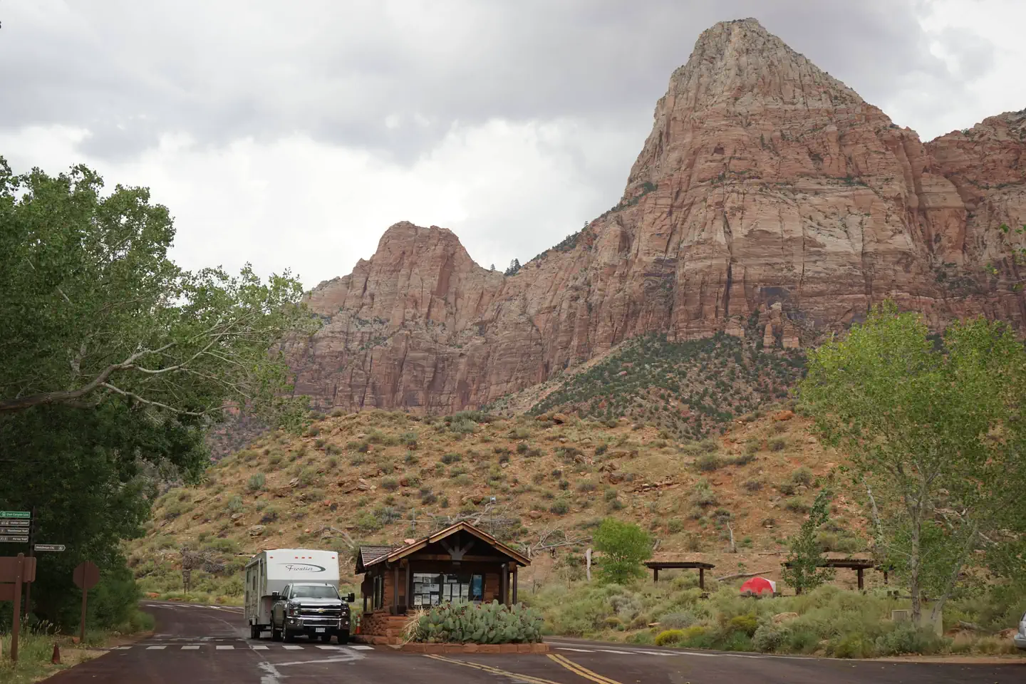
South Campground, located near the south entrance of Zion National Park, offers convenient access to the visitor center and shuttle system. It is open from early March to the end of October, with reservations available up to 14 days in advance. Fo...
From $35/night
Watchman Campground
Watchman Campground is conveniently located near the south entrance of Zion National Park, close to the visitor center and shuttle system. It provides easy access to the park's trails, which are primarily reachable by shuttle from March to Novembe...
Pine Valley Recreation Area
Pine Valley Recreation Area is located in a scenic valley amid the Pine Valley Mountains, featuring campgrounds for families, large groups, and motorhomes. At 6,900 feet elevation, it provides a cool retreat from the Southern Utah desert heat. Vis...
Pine Valley Guard Station
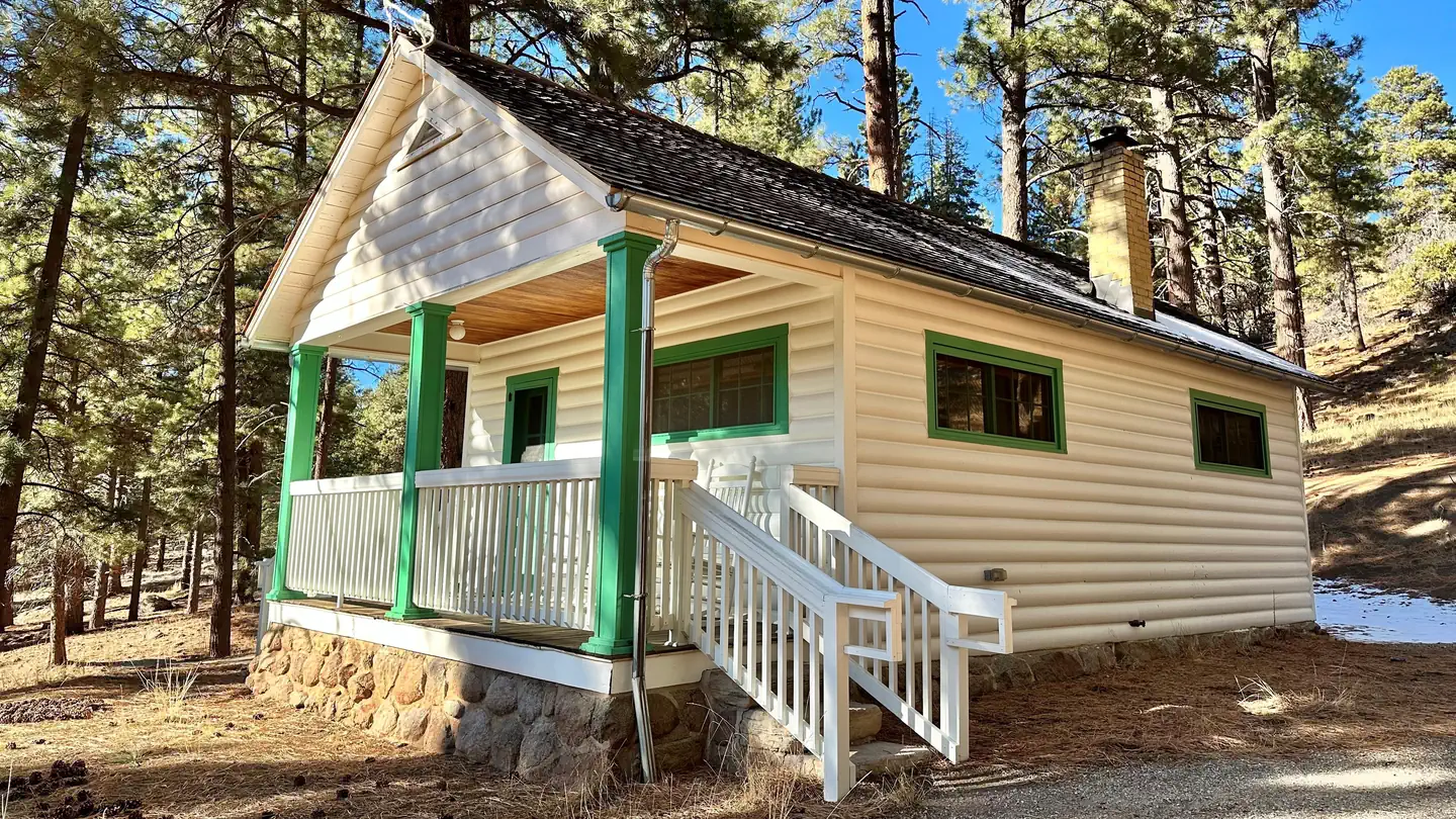
Pine Valley Guard Station, located in the scenic Pine Valley Recreation Area near St. George, Utah, was built in 1935 by the Civilian Conservation Corps to house a recreation guard. The cabin is accessible year-round, though winter access may requ...
McArthur's Temple View RV Resort
Popular Filters
Gateway Luxury RV Resort & Casitas
WillowWind RV Park
WillowWind RV Park in Hurricane, Utah offers a blend of outdoor adventure and modern amenities, nestled among the stunning red rocks of Southern Utah. Guests can easily access attractions like Sand Hollow Reservoir and Zion National Park, with day...
Zion View RV Park
Zion View RV Park offers spacious full-hookup RV sites with various sizes and amenities, including high-speed Wi-Fi and a pet-friendly dog park. Guests can enjoy level concrete pads, picnic tables, and a community fire pit while taking in the beau...
Color Canyon RV Resort
Color Canyon RV Resort offers spacious full-hookup RV sites with various sizes and amenities, including picnic tables and ample room for relaxation. Guests can enjoy clean restrooms, hot showers, laundry facilities, high-speed Wi-Fi, a clubhouse, ...
Zion River Resort
Zion River Resort is a lush oasis located beside the Virgin River, just 15 minutes from Zion National Park. It serves as an ideal base for exploring nearby natural attractions and offers a variety of camping options, excellent guest services, and ...
Zion River Resort RV Park & Campground
Zion Vacation Village
Zion Vacation Village is a newly established campground located 12 miles from Zion National Park, combining comfort with adventure in a scenic valley. Guests can enjoy modern accommodations, including cabins and RV sites, along with top-tier ameni...
Settlers Junction RV Park
Settlers Junction RV Park offers convenient I-15 access, making it the quickest route to Zion National Park and nearby attractions. The oversized sites ensure comfort and privacy, and the newly completed clubhouse provides various amenities. A tra...
Zions Gate RV Resort
Zions Gate RV Resort, located near Zions National Park in southern Utah, offers access to stunning canyons, hiking, and nearby golf and boating activities. The resort features amenities like a heated indoor pool, hot tub, clubhouse, and laundry fa...
St. George / Hurricane KOA Journey
Jellystone Park™ Zion
Red Cliffs Campground
Red Cliffs Recreation Area features a campground, day use areas, and a non-motorized trail system, showcasing dinosaur footprints and the historical presence of Ancestral Puebloans and 19th-century pioneers. The area is situated within the Red Cli...
Settlers Point Luxury RV Resort
Southern Utah RV Resort
Zion Canyon Campground
Zion Canyon Campground, located just 1/2 mile from Zion National Park, has been family-owned since 1973 and offers a range of amenities for RV and tent campers, including full hookups, showers, and a swimming pool. Guests can enjoy local dining op...
South Campground (UT)
South Campground, located near the south entrance of Zion National Park, offers convenient access to the visitor center and shuttle system. It is open from early March to the end of October, with reservations available up to 14 days in advance. Fo...
From $35/night
Watchman Campground
Watchman Campground is conveniently located near the south entrance of Zion National Park, close to the visitor center and shuttle system. It provides easy access to the park's trails, which are primarily reachable by shuttle from March to Novembe...
Pine Valley Recreation Area
Pine Valley Recreation Area is located in a scenic valley amid the Pine Valley Mountains, featuring campgrounds for families, large groups, and motorhomes. At 6,900 feet elevation, it provides a cool retreat from the Southern Utah desert heat. Vis...
Pine Valley Guard Station
Pine Valley Guard Station, located in the scenic Pine Valley Recreation Area near St. George, Utah, was built in 1935 by the Civilian Conservation Corps to house a recreation guard. The cabin is accessible year-round, though winter access may requ...
McArthur's Temple View RV Resort
La Verkin, Utah
Find your perfect stay
The best deals for public & private campgrounds
Check availability & reserve your stay directly
Protect yourself from severe weather events
Frequently Asked Questions
La Verkin has 62 campgrounds and RV parks listed on OutReserve, ranging from full-hookup RV sites to rustic tent camping. Based on guest ratings, Gateway Luxury RV Resort & Casitas is one of the top-rated options. Use our map view to find the closest options to the city center or your preferred area.
Campgrounds near La Verkin vary in distance from the city center. Use our map view to filter by location and find the most convenient option for your trip.
Many campgrounds near La Verkin welcome pets. Watchman Campground is a great pet-friendly option. Use the pet-friendly filter on our search page to find more properties that accommodate your furry companions.
Most destinations offer a variety of accommodations including tent sites, RV sites, cabins, yurts, and glamping options. Check individual property listings for specific amenities and site types.
The best time to visit depends on your preferences and planned activities. Spring and fall typically offer mild weather and fewer crowds, while summer is peak season with the warmest temperatures. Winter visits can be great for those seeking solitude and winter activities.
Nearby cities
List your Campground, RV Park or Resort near La Verkin on OutReserve
Do you own a campground or RV park near La Verkin? List on OutReserve and connect with thousands of outdoor enthusiasts looking to stay in the area.
Free to List
Listing is completely free. You only pay a small commission when you receive a booking: no upfront costs, no hidden fees.
Reach Thousands
Connect with thousands of outdoor enthusiasts actively searching for their next camping adventure. Grow your bookings year-round.
Get Paid Fast
Receive payouts directly to your bank account after each stay. Fast, secure, and reliable so you can focus on your guests.