Warning
GeneralThe following campsite are released on a one-week rolling booking window to provide options for short-term trip planners.Rainy Lake (west end): Mio Beach R64 and Nuthatch R21Rainy Lake (east end): Jack Pine Bench R55 and Hitchcock R105Kabetogama Lake: Fox Farm K50 and Round Bear K29Namakan Lake: Johnson Bay N13 and Hammer Bay South N59Sand Point Lake: South Island S17 and Feldt Channel S5
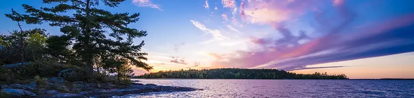


About Voyageurs National Park Camping Permits
Number of accommodations: 159
Seasonal information
2026 Season availability
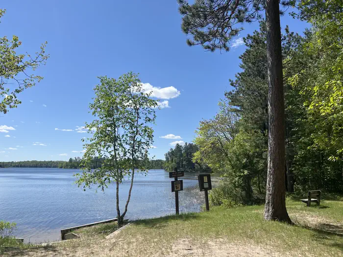
Campground Amenities
Most popular amenities
 Parking
 Picnic Table
 Fire Pit

Cooking and Fire
- Picnic Table
- Fire Pit
- Campfire Ring

Parking and Transport
- Parking

Water Access
- Lake Access
- Boat Ramp / Launch
Report Incorrect Information
Help us improve by reporting any incorrect amenity information for Voyageurs National Park Camping Permits.
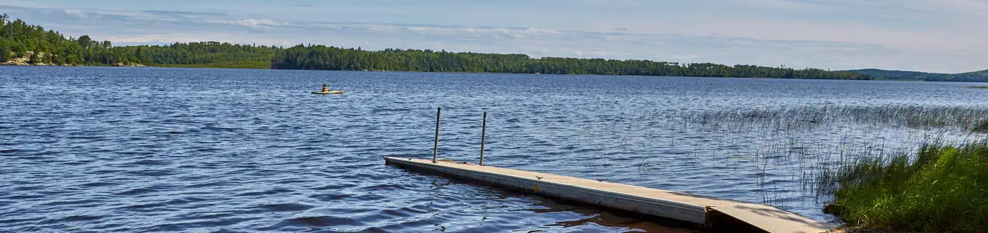
Rates, Sites & Availability
159 Sites Available
No sites found matching your criteria.
No available sites
All sites are booked for your selected dates. Try showing all sites to see booked options, create an alert to be notified when something opens up, or adjust your dates.
Site Details
Select a site to view details
159 Sites Available
No available sites
All sites are booked for your selected dates. Try showing all sites to see booked options, create an alert to be notified when something opens up, or adjust your dates.
Reviews (523)
What Guests Are Saying
Voyageurs National Park offers stunning scenery, spacious and well-maintained campsites, and a variety of wildlife sightings, making it a fantastic destination for camping. The reservation system is convenient, though some users find it cumbersome and prefer the old method of finding campsites. Despite minor inconveniences like overgrown trails and occasional maintenance issues, visitors report enjoyable experiences and express eagerness to return.
Review Summary
Dave M
VerifiedJuly 7, 2022 • Stayed at: Johnson Bay N13, Loop: Namakan Lake
Our group traveled the length of Lake Namakan with two canoes and a 14' aluminum boat with a 5 hp motor. The paddling worked out fine for us, but we only saw two other groups canoeing and boating looked like it was more popular. The navigational buoys and markers were helpful when traveling. We took a weather radio that was useful for planning around the wind.
Have plenty of rope to tie down tents on windy days-we could have used more than we brought.
The fishing was good in general. In late June the birds start chipping before 5am and the sun is up at 5:15am.
A beaver was chewing up one of the canoes at night even though it was Kevlar so we pulled the canoes farther away from the water after that.
The Twin Beach picnic area has a beach on each side of the peninsula. The water on the east side was much warmer than the water on the west side the day we were there so check both sides before swimming.
It was a great trip for us on Namakan but I would suggest planning carefully if you are not strong paddlers.
McKena L
VerifiedJuly 6, 2022 • Stayed at: Namakan Island West N28, Loop: Namakan Lake
So much fun. We canoed to one of the campsites on Namakan and stayed two nights. It took us about 2.5 hours to canoe from the Ash River visitor center. On our full day out, we paddled to Kettle Falls and had some pizza and beer. Round trip took about 7 hours total - we did have to paddle against a current near Kettle Falls, but it wasn't terrible.
All three days brought a mix of clear blue skies and surprise rain. The mosquitos on land were bad so we didn't do any hiking, but no mosquitos out on the water!
People in motorboats we're polite and gave us plenty of space. She everyone waved.
Shaun G
VerifiedJuly 2, 2022 • Stayed at: Swansons Bay S24, Loop: Sand Point Lake
Loved this place annually and more for 30 years. Even with high water it was great!
Mike P
VerifiedJuly 2, 2022 • Stayed at: C. Vic Linsten K5, Loop: Kabetogama Lake
Despite the extremely high water having recently done damage, we still had a great time and were able to make do with things the way they were at the time. I hope the park service can fix things up and we are Extremely Grateful for the service you guys provide!!
Brett V
VerifiedJune 8, 2022 • Stayed at: Shelter Bay K30, Loop: Kabetogama Lake
I have been reserving the same site for 10+ years now and this year I did the same thing I do every year on November 15th 9:00 AM central I was there to reserve site and I did not get it. I should have some type of priority do to reserving same time every year for that site. What can I do to ensure that I get this site next year?
Chris A
VerifiedJune 7, 2022 • Stayed at: Nuthatch R21, Loop: Rainy Lake
There was six feet of extra water in the lake
Dock was under water
Our camping trip was cut two days short because the park rangers told us that the park was closing
Ronald C
VerifiedMay 29, 2022 • Stayed at: Sheen Point N38, Loop: Namakan Lake
5/9/2022. Very high water levels this spring. I arrived at the Sheen Point campsite on Namakan May 17 and left on May 22. The campsite dock was underwater 15" but I could beach the boat. When I left the dock was underwater 23". The lower tent pad was no more than a foot above water level, so if you're headed there, be prepared. The lake level has risen since then. You might have use of only the upper tent pad. Otherwise, a great trip as usual.
The National Park website has alerts on the high water conditions, but actual specifics for water level and campsite conditions are lacking and infrequently updated. Calling the visitor center at Rainy Lake wasn't helpful for me because I had to leave a message and got no reply until after I was already there.
tom h
VerifiedMay 28, 2022 • Stayed at: Bald Rock K1, Loop: Kabetogama Lake
high water restricted activity. no camping
Neil G
VerifiedMay 23, 2022 • Stayed at: Whites Point R47, Loop: Rainy Lake
An easy website to book your camping requirements. However, the requirement to add your vehicle details should be changed from mandatory to optional. If you travel from outside the US and book a rental car, you do not have the required information (licence plate etc/car type) to complete this at the time of booking, and so have to add incorrect information just to be able to complete the booking. This needs to be changed!
Alan H
VerifiedMay 18, 2022 • Stayed at: Peterson Point K25, Loop: Kabetogama Lake
Nice site, water was way high for time of year, dock was unusable but understandable with high water.
Location Voyageurs National Park Camping Permits
Address:
Voyageurs National Park Headquarters
International Falls, MN, 56649
United States
VEHICLE:
Voyageurs National Park is approximately 5 hours north of Minneapolis-St. Paul on I-35 and Hwy 53, 3 hours north of Duluth on Hwy 53, and 4 hours south from Winnipeg, Manitoba.
PLANE:
Falls International Airport is located in International Falls, Minnesota. Taxi service and rental cars are available here. Most flights entering the area will pass through the larger Minneapolis-St. Paul airport located around 5 hours south of Voyageurs National Park.
PUBLIC TRANSPORTATION:
There is no public transportation to Voyageurs National Park. No bus lines or passenger trains serve this area.
Voyageurs National Park is accessible via Highway 53, which connects to Interstate 35 to the south. The park is located approximately 5 hours north of Minneapolis-St. Paul on I-35 and Hwy 53.
Latitude & Longitude: 48.6028 / -93.3768
Elevation: 340 feet
Policies & Rules
Arrival & departure
Check in time
3PM
Check out time
12PM
General
- It is required to view the Voyageurs National Park Camping Video in its entirety prior to payment.
- You are responsible for ensuring all information contained within the Voyageurs National Park Camping Video is acknowledged and followed by all members of your group.
- Permits: You must log into your recreation.gov account to print your permit and bring it with you to your site. Five days prior to your trip, the Print Permit button will be enabled in the Reservations section of your recreation.gov account. Chrome or Edge are the recommended browser for recreation.gov. NOTE: permits currently cannot be printed via the rec.gov app - please print directly from www.recreation.gov.
- Display your permit in the waterproof box provided on the bear locker at your frontcountry site. In the backcountry, keep your permit with you.
- Access: All frontcountry and backcountry sites require travel by boat. You must use your own private watercraft, or arrange for boat rental or water taxi from these options to reach frontcountry campsites or backcountry trailheads.
- Backcountry:
- SPECIAL CONSIDERATIONS IN THE BACKCOUNTRY: These sites first require travel by private watercraft or water taxi to a trailhead, and then hiking up to several miles to the campsite. Private watercrafts must be left at the trailhead and not portaged into backcountry lakes. Once in the backcounty, a combination code is needed to unlock and use the park's canoes. Be certain that you have made a reservation and and bring your permit as it will include this information. To prevent the spread of aquatic invasive species: private watercrafts cannot be portaged into backcountry lakes, nor can float planes land on them; use artificial bait only; all gear must be decontaminated or dried for 5 days prior to using in backcountry lakes; clean all water, plants, mud, etc. from gear before leaving a lake. Bring in and wear your own Personal Flotation Device (PFD); only canoes and paddles are provided with a canoe reservation. Bring rope to hang food in case a bear pole is not present, and always treat lake water before using it for drinking or cooking.
- Campfires: Fires are allowed in designated metal fire rings only. Do not burn trash, pack everything out - there are trash and recycling receptacles at the boat landings.Lighting or maintaining a fire with flammable liquids, garbage, fireworks, plastics, aerosol canisters, batteries, or other manufactured materials not designed for fire lighting or maintenance is prohibited. See 36 CFR § 2.13(a)(1) for full details.
- Bear Safety: Use the provided bear lockers (in frontcountry) and bear poles (in backcountry) to prevent bear interactions. Report animal encounters to a visitor center.
- Wood gathering: Chainsaws are not allowed at campsites. Bring DNR-approved firewood with you in frontcountry. Do not cut or damage standing vegetation, living or dead. Only dead and downed wood may be collected for fires.
- Water: it is suggested to haul in water to your campsite. Potable water is available at all park visitor centers.
- Maximum group size: small campsite - 9; large campsite - 18; group campsite - 30; backcountry & primitive sites - 6; canoe permit - 3
- Cell phone coverage varies throughout the park. Marine band radios are suggested, as rangers and local law enforcement monitor marine channel 16.
- Keep the next camper in mind and leave the campsite in the condition you would like to find it in.
Warnings & Advisories
Warning
GeneralThe following campsite are released on a one-week rolling booking window to provide options for short-term trip planners.Rainy Lake (west end): Mio Beach R64 and Nuthatch R21Rainy Lake (east end): Jack Pine Bench R55 and Hitchcock R105Kabetogama Lake: Fox Farm K50 and Round Bear K29Namakan Lake: Johnson Bay N13 and Hammer Bay South N59Sand Point Lake: South Island S17 and Feldt Channel S5
Nearby Campgrounds
Nearby destinations
Last updated: July 11, 2026