Top Campgrounds near Peach Springs
Popular Filters
Point of Rocks RV Campground
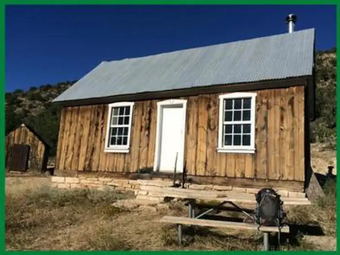
Jumpup Cabin
Jumpup Cabin, established in the 1900s, has served ranchers and the Forest Service and is on the National Register of Historic Places. The site features a historic two-room cabin, a shed, and a composting toilet.
Atlatl Rock Campground
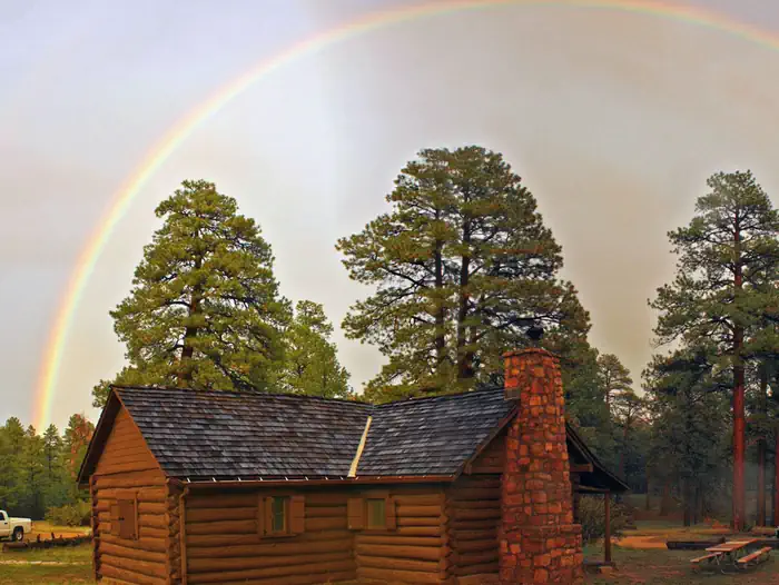
Hull Cabin
Hull Cabin, the oldest historic structure near the Grand Canyon National Park, offers various amenities and access to recreational activities in the Kaibab National Forest. Visitors can enjoy trails, fishing, and wildlife viewing. Access is by veh...
White Spar Campground
White Spar Campground, located at 5,641 feet and just 2.7 miles from downtown Prescott, offers a mild climate and a serene ponderosa pine forest. It provides various outdoor activities like camping, hiking, and mountain biking, with several loop t...
North Rim Campground (AZ)
North Rim Campground is situated on the North Rim of Grand Canyon National Park in a forested area at an elevation of 8,200 feet, about 210 miles from the South Rim. It is ideal for tent camping and smaller RVs, but large or high-profile RVs are n...
Paiute Wilderness Area
The Paiute Wilderness Area spans 87,900 acres southwest of St. George, Utah, featuring the Virgin Mountains and the highest peak, Mt. Bangs, at 8,012 feet. It boasts diverse vegetation and is home to over 250 animal species. The area prohibits mot...
Lynx Campground
Lynx Campground, located at 5,600 feet in the Lynx Lake Recreation Area, is situated along the west shoreline of Lynx Lake, just 7 miles southeast of Prescott, Arizona. Reservations can be made online or by calling 1 (877) 444-6777. For general in...
Potato Patch Campground
Potato Patch Campground is a tranquil site in central Arizona, offering cool temperatures and easy access from Hwy 89A. Situated at 7,200 ft. elevation among ponderosa pines, it lies between Mingus Mountain and Woodchute Wilderness. Reservations c...
Village Camp Flagstaff
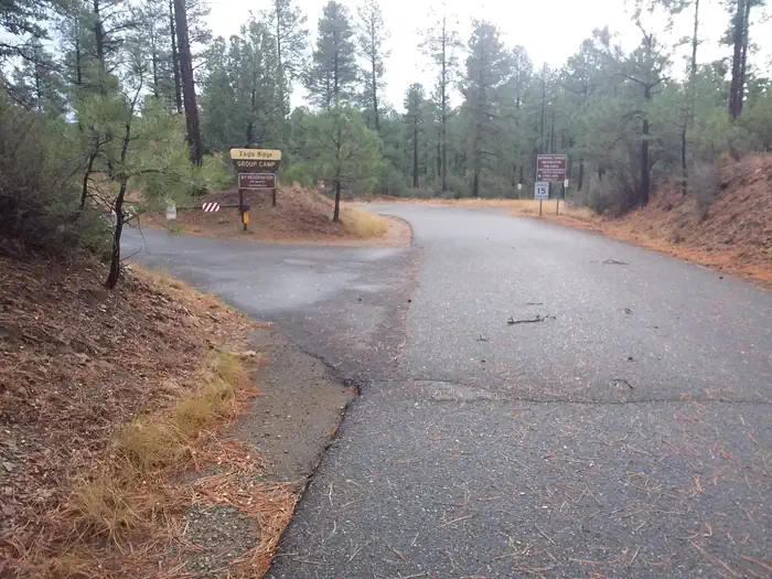
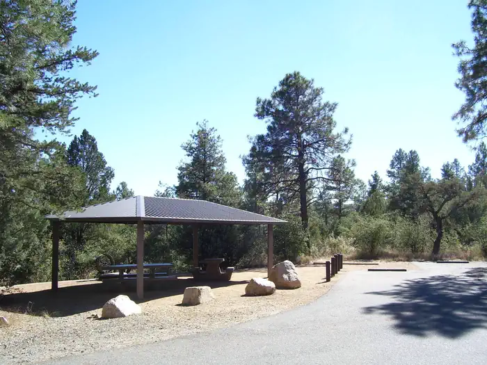
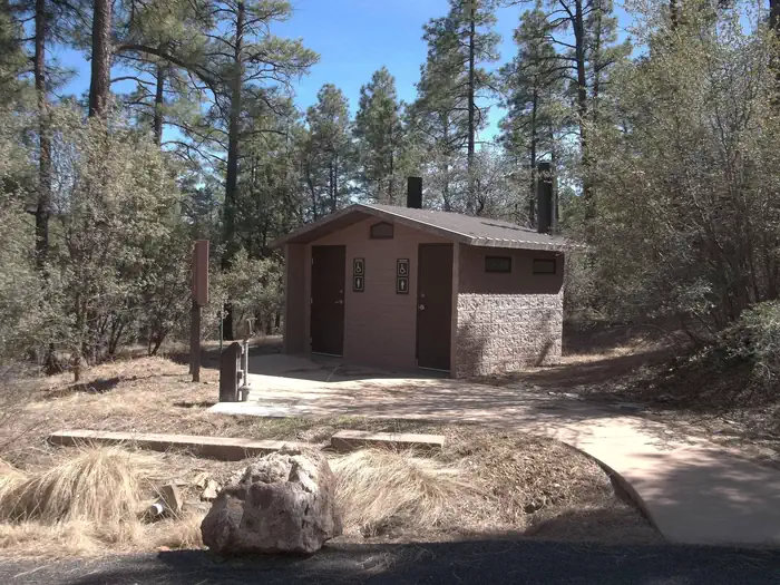
Eagle Ridge Group Campground
Eagle Ridge Group Campground is located in a ponderosa pine forest within Prescott National Forest, near Lynx Lake and the historic town of Prescott, Arizona. It offers summer visitors opportunities for camping, fishing, picnicking, hiking, and mo...
Hilltop Campground (AZ)
Hilltop Campground is situated in the Prescott Basin at an elevation of 5,712 feet, offering a cool ponderosa pine forest and mild weather. It provides a variety of recreational activities such as boating, fishing, hiking, and mountain biking, wit...
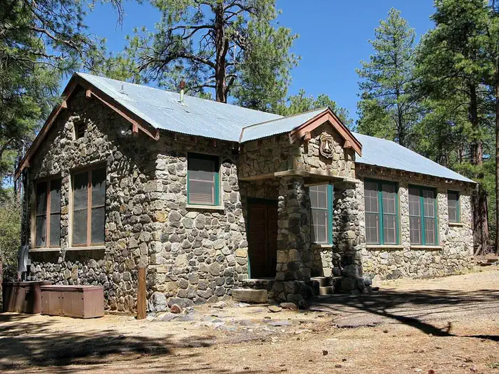
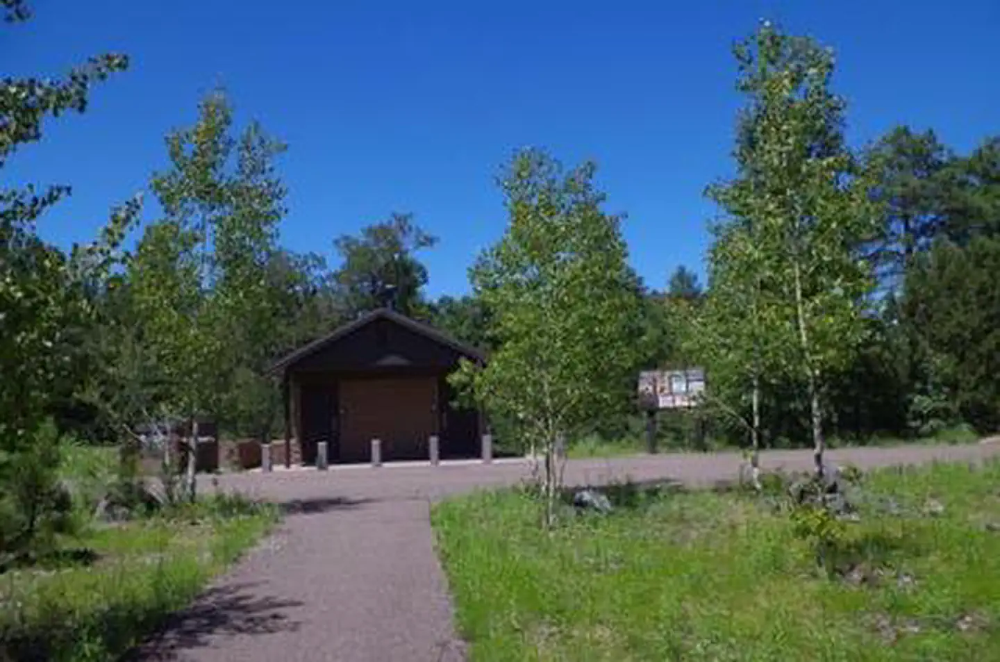
Groom Creek Schoolhouse
Groom Creek Schoolhouse, built in 1902, is a historic venue in Arizona's Prescott National Forest available for day use by groups of up to 60 people, featuring both indoor and outdoor spaces. Originally serving 10 to 15 children until 1952, it is ...
Groom Creek Horse Camp
Groom Creek Horse Camp is located seven miles south of Prescott, Arizona, at an elevation of 6,398 feet, and is popular among equestrian campers due to its ponderosa pine setting and nearby trails. Each campsite features a steel corral enclosure f...
Upper Wolf Creek Group
Upper Wolf Creek Group Campground offers a peaceful forest environment for groups of up to 100 campers, located 8 miles from Prescott, Arizona. It provides nearby town amenities and recreational opportunities, including trails and lakes. Reservati...
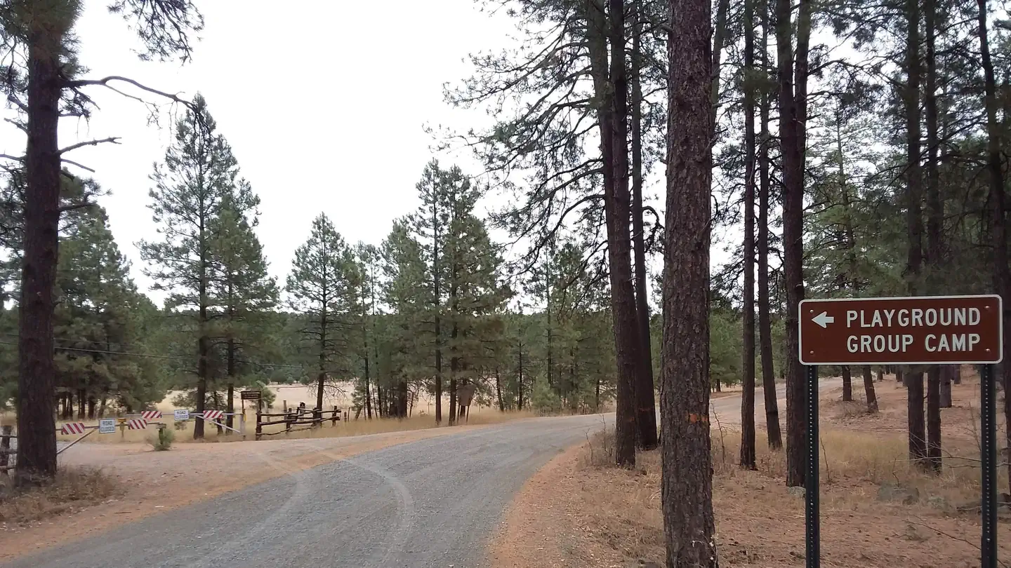
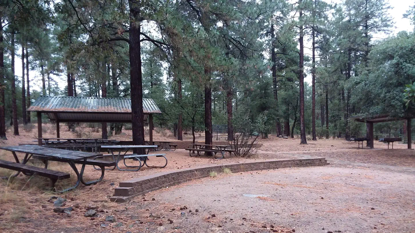
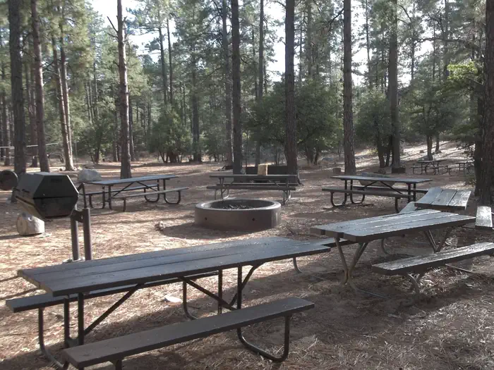
Playground Group
Playground Group Campground, located in Arizona near historic western towns, accommodates groups of up to 75 people for a secluded mountain retreat. Situated at 7,500 feet on Mingus Mountain in Prescott National Forest, it offers stunning views of...
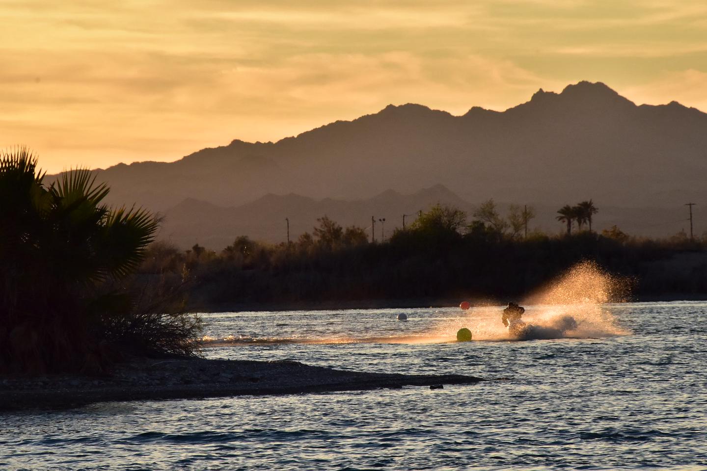
Lake Havasu Shoreline Sites
The Lake Havasu Field Offices manage 73 boat access campsites along the Arizona shore, equipped with amenities like picnic tables, grills, restrooms, and shade structures. These sites are available on a first-come, first-served basis with a 14-day...
Kendrick Cabin
Kendrick Cabin accommodates up to 10 guests, offering stunning mountain views and access to hiking and biking trails, as well as cultural attractions in the Southwest. This rustic, three-bedroom cabin, built in the 1960s as a U.S. Forest Service f...
Sun Resorts RV Park
Mesquite Trails RV Resort
Popular Filters
Point of Rocks RV Campground
Jumpup Cabin
Jumpup Cabin, established in the 1900s, has served ranchers and the Forest Service and is on the National Register of Historic Places. The site features a historic two-room cabin, a shed, and a composting toilet.
Atlatl Rock Campground
Hull Cabin
Hull Cabin, the oldest historic structure near the Grand Canyon National Park, offers various amenities and access to recreational activities in the Kaibab National Forest. Visitors can enjoy trails, fishing, and wildlife viewing. Access is by veh...
White Spar Campground
White Spar Campground, located at 5,641 feet and just 2.7 miles from downtown Prescott, offers a mild climate and a serene ponderosa pine forest. It provides various outdoor activities like camping, hiking, and mountain biking, with several loop t...
North Rim Campground (AZ)
North Rim Campground is situated on the North Rim of Grand Canyon National Park in a forested area at an elevation of 8,200 feet, about 210 miles from the South Rim. It is ideal for tent camping and smaller RVs, but large or high-profile RVs are n...
Paiute Wilderness Area
The Paiute Wilderness Area spans 87,900 acres southwest of St. George, Utah, featuring the Virgin Mountains and the highest peak, Mt. Bangs, at 8,012 feet. It boasts diverse vegetation and is home to over 250 animal species. The area prohibits mot...
Lynx Campground
Lynx Campground, located at 5,600 feet in the Lynx Lake Recreation Area, is situated along the west shoreline of Lynx Lake, just 7 miles southeast of Prescott, Arizona. Reservations can be made online or by calling 1 (877) 444-6777. For general in...
Potato Patch Campground
Potato Patch Campground is a tranquil site in central Arizona, offering cool temperatures and easy access from Hwy 89A. Situated at 7,200 ft. elevation among ponderosa pines, it lies between Mingus Mountain and Woodchute Wilderness. Reservations c...
Village Camp Flagstaff
Eagle Ridge Group Campground
Eagle Ridge Group Campground is located in a ponderosa pine forest within Prescott National Forest, near Lynx Lake and the historic town of Prescott, Arizona. It offers summer visitors opportunities for camping, fishing, picnicking, hiking, and mo...
Hilltop Campground (AZ)
Hilltop Campground is situated in the Prescott Basin at an elevation of 5,712 feet, offering a cool ponderosa pine forest and mild weather. It provides a variety of recreational activities such as boating, fishing, hiking, and mountain biking, wit...
Groom Creek Schoolhouse
Groom Creek Schoolhouse, built in 1902, is a historic venue in Arizona's Prescott National Forest available for day use by groups of up to 60 people, featuring both indoor and outdoor spaces. Originally serving 10 to 15 children until 1952, it is ...
Groom Creek Horse Camp
Groom Creek Horse Camp is located seven miles south of Prescott, Arizona, at an elevation of 6,398 feet, and is popular among equestrian campers due to its ponderosa pine setting and nearby trails. Each campsite features a steel corral enclosure f...
Upper Wolf Creek Group
Upper Wolf Creek Group Campground offers a peaceful forest environment for groups of up to 100 campers, located 8 miles from Prescott, Arizona. It provides nearby town amenities and recreational opportunities, including trails and lakes. Reservati...
Playground Group
Playground Group Campground, located in Arizona near historic western towns, accommodates groups of up to 75 people for a secluded mountain retreat. Situated at 7,500 feet on Mingus Mountain in Prescott National Forest, it offers stunning views of...
Lake Havasu Shoreline Sites
The Lake Havasu Field Offices manage 73 boat access campsites along the Arizona shore, equipped with amenities like picnic tables, grills, restrooms, and shade structures. These sites are available on a first-come, first-served basis with a 14-day...
Kendrick Cabin
Kendrick Cabin accommodates up to 10 guests, offering stunning mountain views and access to hiking and biking trails, as well as cultural attractions in the Southwest. This rustic, three-bedroom cabin, built in the 1960s as a U.S. Forest Service f...
Sun Resorts RV Park
Mesquite Trails RV Resort
Peach Springs, Arizona
Find your perfect stay
The best deals for public & private campgrounds
Check availability & reserve your stay directly
Protect yourself from severe weather events
Frequently Asked Questions
Most destinations offer a variety of accommodations including tent sites, RV sites, cabins, yurts, and glamping options. Check individual property listings for specific amenities and site types.
The best time to visit depends on your preferences and planned activities. Spring and fall typically offer mild weather and fewer crowds, while summer is peak season with the warmest temperatures. Winter visits can be great for those seeking solitude and winter activities.
We highly recommend making reservations in advance, especially during peak season (summer months and holidays). Popular destinations can book up weeks or even months ahead. Last-minute bookings may be available during off-peak times.
Pet policies vary by property. Many campgrounds welcome pets but may have restrictions on size, breed, or number of pets. Some properties charge additional pet fees. Always check the specific property's pet policy before booking.
Essential items include a tent or RV, sleeping bags, cooking equipment, food and water, appropriate clothing for the weather, first aid kit, flashlight, and any specific gear for planned activities. Check the property's amenities to see what's provided and what you'll need to bring.
Nearby destinations
List your Campground, RV Park or Resort near Peach Springs on OutReserve
Do you own a campground or RV park near Peach Springs? List on OutReserve and connect with thousands of outdoor enthusiasts looking to stay in the area.
Free to List
Listing is completely free. You only pay a small commission when you receive a booking: no upfront costs, no hidden fees.
Reach Thousands
Connect with thousands of outdoor enthusiasts actively searching for their next camping adventure. Grow your bookings year-round.
Get Paid Fast
Receive payouts directly to your bank account after each stay. Fast, secure, and reliable so you can focus on your guests.